


Fri, Dec 8th, 2023 - 5:18pm
February 23, 2021 - 7:11am | By Dean Wysocki
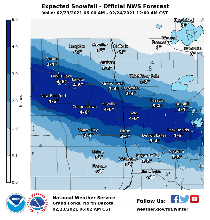
WINTER WEATHER ADVISORY TODAY: The largest snow we have had this "season" was back on Oct. 20th where F/M area picked up 4.2" of snow. This system will drop close to our seasonal high. Check out the maps above and notice how narrow the band of snow is. Only about a 50mi to 75 mi wide band of "heavier" snow. A slight shift in the track of the storm will alter amounts significantly. Our latest computer model runs (6am) are targeting the area from New Rockford through Cooperstown and F/M area.where 3-5" is likely. Some local areas could pick up 6" of snow. This will be that heavy wet snow so be careful if you are shoveling. Evening commute will be messy. Temps after this storm will remain above normal with temps remaining in the 20s and 30s before colder weather pushes in this weekend. March still looks to be an active month in regards of multiple storms.
Chief Meteorologist,
Dean Wysocki


