


Wed, Apr 19th, 2023 - 7:50am
March 29, 2021 - 9:02am | By Justin Storm
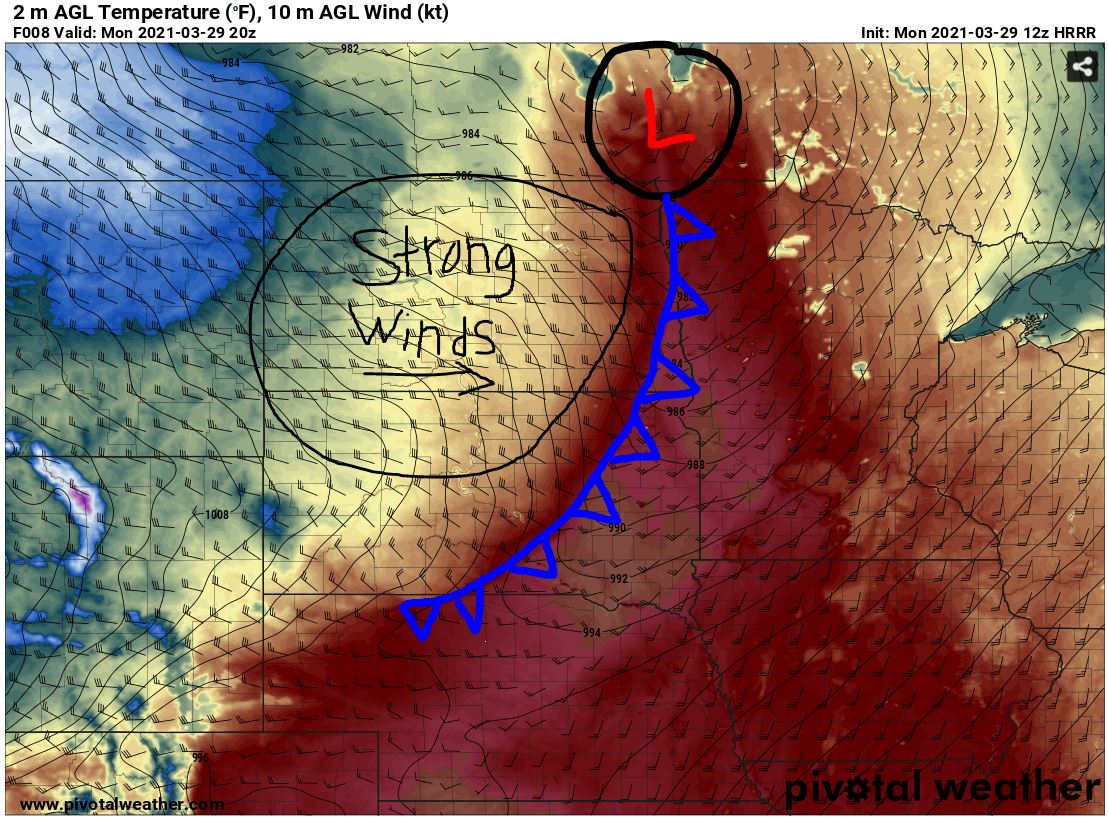
A strong low-pressure system is located to our north moving to the east throughout the day. This will bring higher temperatures to the valley from the south as well as strong winds due to the pressure gradient.
Red Flag Warnings have been issued all across the Northern Great Plains stretching down to the northern panhandle of Texas. High Wind Warnings are issued everywhere west of the Valley into eastern Montana while the valley remains in a Wind Advisory currently as of (8:55 AM 3-29-2021). No record-breaking warmth for today but close! A high of 73 in F/M today, just 3 degrees shy of the record of 76 set in 1986.
For the first half of our day, sunny with south winds between 15-25 with gust up to 40mph. A cold front will quickly move through this afternoon which will increase the clouds briefly and switch our winds out of the west between 30-40 with gust as high as 60mph. We will drop in temperature Tuesday and Wednesday to the low/mid 30's but rebound back to the upper 60's/mid 70's for our weekend while remaining breezy.
Check your full 7-day forecast on our website!
Meteorologist,
Justin Storm


