Fri, Feb 9th, 2024 - 3:12pm
December 14, 2021 - 3:06pm | By Justin Storm

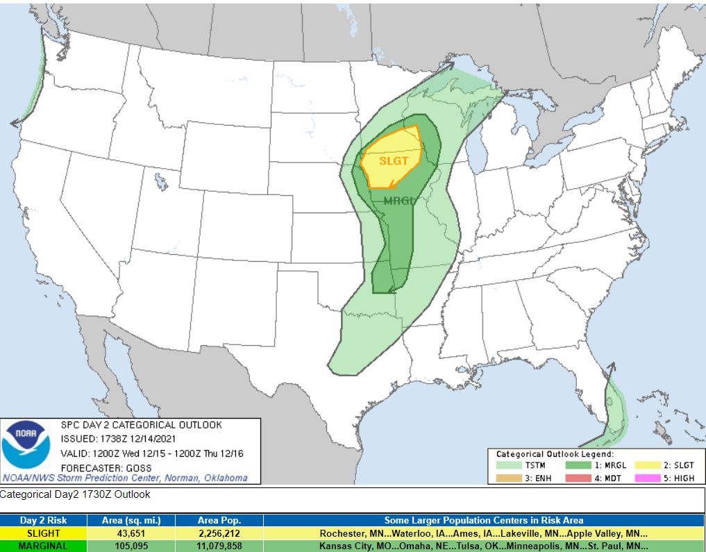
As we head through Wednesday (12/15/2021), a fast, strong, and sizeable low-pressure system will lift into Minnesota from the SW. This system will enter the area late afternoon to early evening bringing windy conditions, rain, and snow. Severe thunderstorms are possible in southern Minnesota and Iowa, including an isolated tornado possible. Let us think about that for a second... southern Minnesota just got a foot and a half of snow, and now there is a potential tornado threat a few days later, absolutely crazy! This enters late Wednesday afternoon to early evening and ends overnight.
The quickly moving storm system entering Wednesday still has a bit of uncertainty with where exactly the heaviest snow will fall? Where is the low going to track? How fast will the low track through our area? All of these play a significant role in how this storm impacts our area. This storm system is very complicated and is still providing a good range of impacts within the computer models. Models seem to be having a hard time determining where precisely this storm will track and other factors, including where the freezing line will set up. Typically models handle these storms reasonably well, and if this was our typical storm, we could be looking at a big snowmaker. However, this isn't our standard storm system. Models will get more in agreement as the storm system makes its way on land, which it does this evening. So tonight's new model runs, and tomorrow morning models especially will have a much better picture of the storm, hopefully ;)
The current track of the low is forecasted to come off the Rockies through Sioux Falls, SD, towards Duluth, MN. Any deviation from the path will increase (to the north) or decrease (further south southeast) our snow totals.
The storm is forecasted to enter our area at a similar central pressure to a category one hurricane. Now I'm not saying this storm is a hurricane, but the central pressure is similar to one. We're expecting very windy conditions gusting to 50 mph come Wednesday night, with a winter mix turning over to snow through the evening. As of now, 1-4 inches of snow is what we're forecasting for eastern ND, less in the northern valley, and a narrow band of 4-7+" to our east. Blowing snow may drastically reduce visibility late Wednesday and overnight.
This however, may and will likely change as we head into tomorrow as we obtain new mid and upper atmospheric data on the storm system. I suspect the models may be under-resolving the storm, but we will have to wait and see. This ultimately all comes down to where precisely the low tracks, the organizations, and a couple of other complicated factors that would increase precipitation. Specifically, I'm referring to the deformation zone, but I won't dive into that detail.
What follows this storm is a few more chances for snow Friday night and Sunday and much colder air. Not arctic air but temperatures in the teens through next week, except this Sunday.
Attached below is the current 3:00 PM CDT 12/14/21 Storm Prediction Center convective outlook for Wednesday.
Make sure you stay tuned here as we learn more about this complex and developing system coming off the Pacific.
Meteorologist,
Justin Storm