


Mon, Jul 17th, 2023 - 10:42am
January 08, 2022 - 9:05am | By Justin Storm
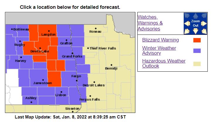
A Ground blizzard warning has been issued to the west of Fargo from valley city northward of Devils Lake ND. This is in effect until 9:00 PM CDT for gust as high as 50 mph. Expect Reduced visibility and difficult traveling. Surrounding the Blizzard warning is a winter weather advisory. This runs through the day from 11:00 AM until 9:00 PM as well. Difficult traveling is expected with a ground blizzard to near ground blizzard conditions from NW winds gusting as high as 40-50 mph.
As a cold front drags across ND ground blizzard to near ground blizzard conditions are expected. Temperatures will be falling through the day. Winds will be from the NW 20-30 mph and gusting as high as 50 to our west, near 40 in far eastern ND. Winds will lighten up as we head into tonight with temperatures plunging to near 15-20 below across the area. Wind chills will drop to 30-40 below. Cold air will be setting in through Monday with highs below 0 before we begin to warm things back up into the 20's by mid-next week!


