


Mon, Oct 30th, 2023 - 3:53pm
April 12, 2022 - 6:55pm | By Justin Storm
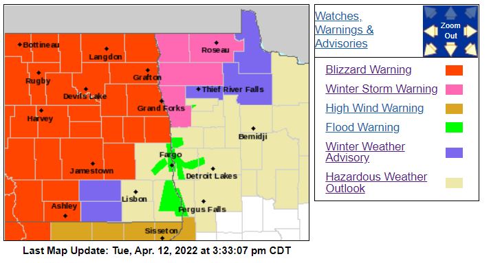
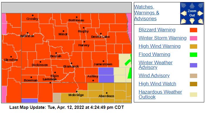
Widespread blizzard conditions across the state will continue into Thursday, where warnings are, as of now, set to expire at 7:00 PM.
A freeze line is dividing Cass County into the central valley near Hillsboro with heavy snow and blizzard conditions north and west and rain south. This will inch closer to Fargo as we head into this evening and tonight, where we could see some snow mix overnight and tomorrow early morning. This evening and tonight, rain continues in Fargo, possibly mixing into snow overnight with east winds between 20-40 mph. Wind lightens up a touch overnight into tomorrow morning but returns later in the day Wednesday from the SW, then NW between 25-50 mph and gusting even higher at times close to 60 mph. Things go dry in far eastern ND into Minnesota on Wednesday as the dry slot enters the area before wrap-around snow fills back in Wednesday evening and overnight. However, it will continue to snow through the day out west, from Jamestown to Devils Lake, and points westward with strong wind through. Scattered snow showers will continue for Thursday with wind from the NW between 25-50 mph. This will be the most impactful timeframe for Fargo, Wednesday night and Thursday.
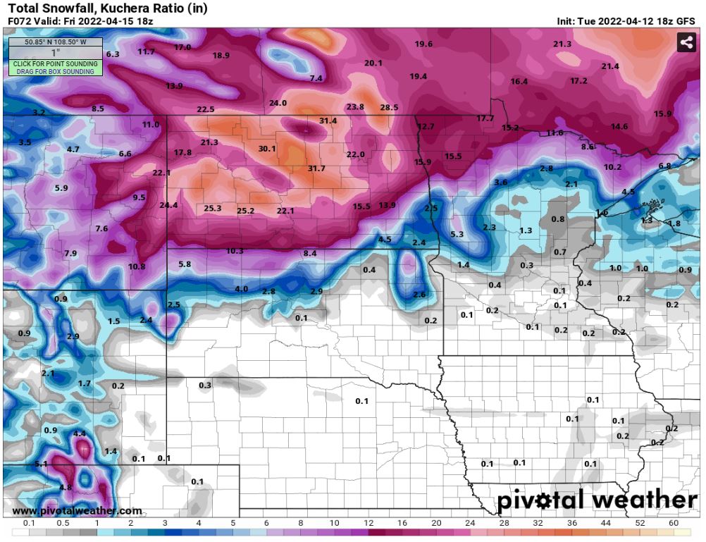
Due to heavy banding in the northern valley, amounts have been bumped to 12-18" from Devils Lake into NW Minnesota, amounts of 6-12+ still likely from valley city to Jamestown, while Fargo remains mostly snow-free until Wednesday night. Then wrap-around snow looks to bring 1-3 inches of snow into the southern valley over to Lakes country with localized areas up to 5-6 inches depending on banding. Check out a few of the maps I've attached on expected snow accumulation across the area. The "heaviest" snow will remain out west, where amounts up to 36 inches of snow still look possible!
Make sure you check the latest NDDOT on roads, I-94 is closed, and many incidents are being reported! More closures will continue through the day. I wouldn't be surprised to see most of the state closed from this storm!
Meteorologist,
Justin storm