


Thu, Feb 1st, 2024 - 4:17pm
June 27, 2022 - 3:55pm | By Justin Storm
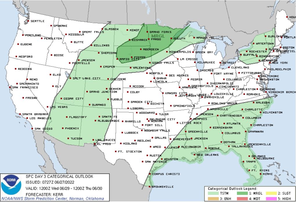
Temperatures this week look to remain fairly mild in the 70s and 80s. It will come with a few chances for rain and even a couple of thunderstorms, along with the windy conditions were all used to. A cold front will track from the north to the south Tuesday morning. I do expect some showers to develop along this front which will give the Fargo area a slight chance for some showers from Tuesday morning to early afternoon. Then cooler and breezy conditions will remain through the rest of the day. Partly cloudy with a north wind 10-20 mph gusting up to 30 mph with high temperatures in the upper 60s to lower 70s. Temperatures will recover back to the mid 80s to lower 90s Wednesday, but it will come with a better chance for some scattered showers and even a couple of thunderstorms and windy conditions from the SE between 15-30 mph and gusty. One or two storms could be stronger to marginally severe. Attached above is the SPC outlook for Wednesday as of Monday, 6/27/22. A slight chance for thundershowers will remain on Thursday. Windy conditions continue with highs near 80. Sunny skies return on Friday with breezy conditions before our next chance for some showers comes over the weekend.
What about the holiday weekend?
Well, the weekend is still coming into focus within our longer-range computer models. The LRC prediction forecasts two storm systems just before and just after the Fourth of July. Models are picking up on both of these storm systems, but placement and timing are not in agreement as it usually is not. Positioning and timing will likely change as the weekend comes more into focus. As things look right now, in my opinion, these waves look to come in overnight Saturday into Sunday and remain just to our south in South Dakota. More conflict comes in on the second wave. Our two longer-range models are "fighting" on the timing. Both agree on this storm system tracking through North Dakota, but one model Is trying to pull these storms in Monday night into Tuesday, while our "more reliable" model is holding these storms off until Tuesday.
I will continue to monitor these two disturbances as the week continues. Still, I'm leaving a slight chance for some thunderstorms Saturday night (20%), a 20% chance for some isolated showers on Sunday morning, and a 20% chance for some storms Monday night. The LRC calendar is attached below and predicts a storm system Saturday into Sunday ( which again looks to pass mostly to our south), Tuesday into Wednesday as well as Friday.


