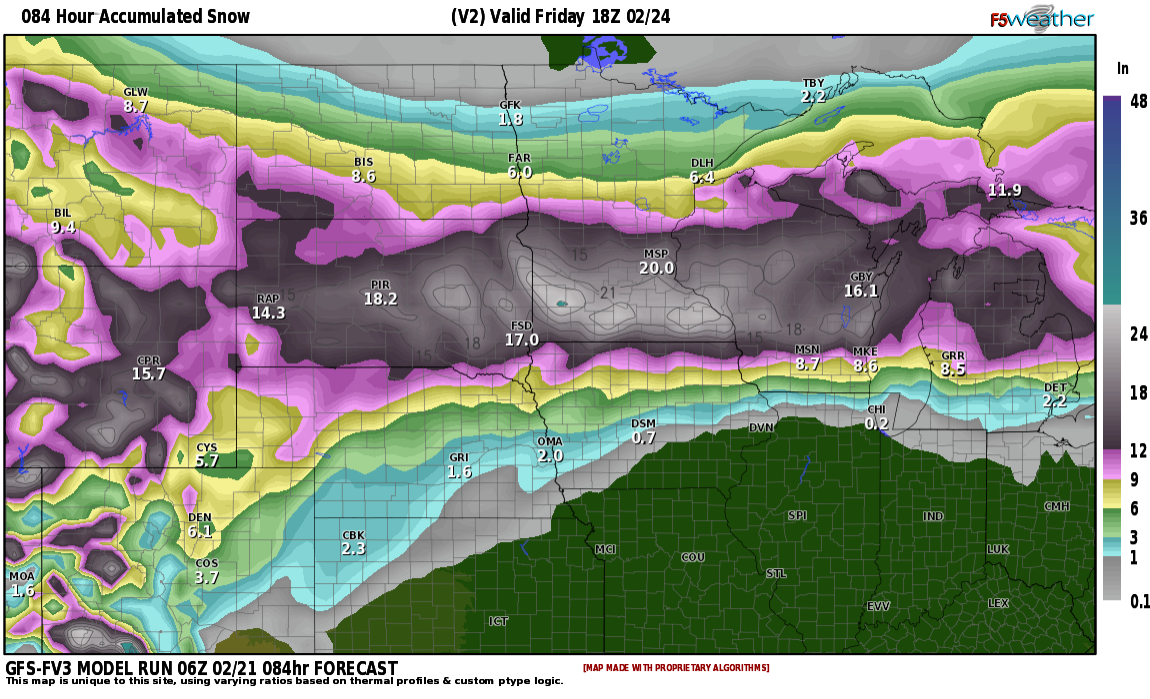
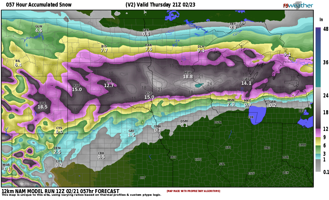
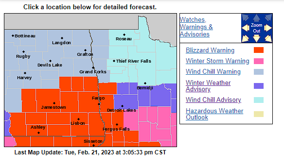
MORE SNOW!!! oh joy! FIRST the good news!! Fargo area will not get the BRUNT of this storm as that will lie to our south. (See attached warnings in SD and MN) With that being said, there is a decent chance for blizzard/near blizzard conditions along and south of I94 corridor Wednesday night and especially Thursday. As you can see by the attached maps, total snowfall around the F/M area through Thursday should be around 5-8" Winds will be increasing on Wednesday about 20-30 mph out of the north. Winds increase even further on Thursday with winds gusting 40+ mph leading to blowing and drifting snow with near zero visibility at times.
The models have been trending a bit south with the storm which may decrease amounts in the F/M area but not by too much. If the storms tracks a bit farther north, which a few models are hinting, we could increase totals in the F/M area by a few inches. There will be a sharp cutoff in snowfall totals as you track north with the northern valley not seeing much snow at all . Travel is NOT recommended along and south of the 94 corridor starting Wednesday night into Thursday. Look at the bright side, even with our conditions deteriorating, at least we won't be dealing with what the Minneapolis area may be receiving which is around 16-22" of snow.
Mark you calendars to a week after Easter (approx.) as the LRC cycle which is bringing us these storms will cycle back in 50 days. By then we are in April and HOPEFULLY we will see rain out of the storms by then, but I wouldn't bank on it.
Chief Meteorologist,
Dean Wysocki