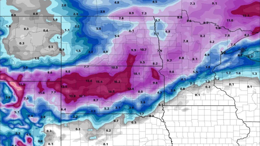
We haven’t had a harsh winter in regards to BIG storms, however, that may be changing as we head into later this week. All models are in agreement of SOME snow for the F/M area. The question is how much? What we look for is CONSITENCY in the models and not flip-flopping back and forth. So, with that being said, here is a look at 2 of our more consistent models predictions of how much snow for our area:
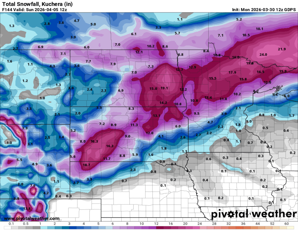
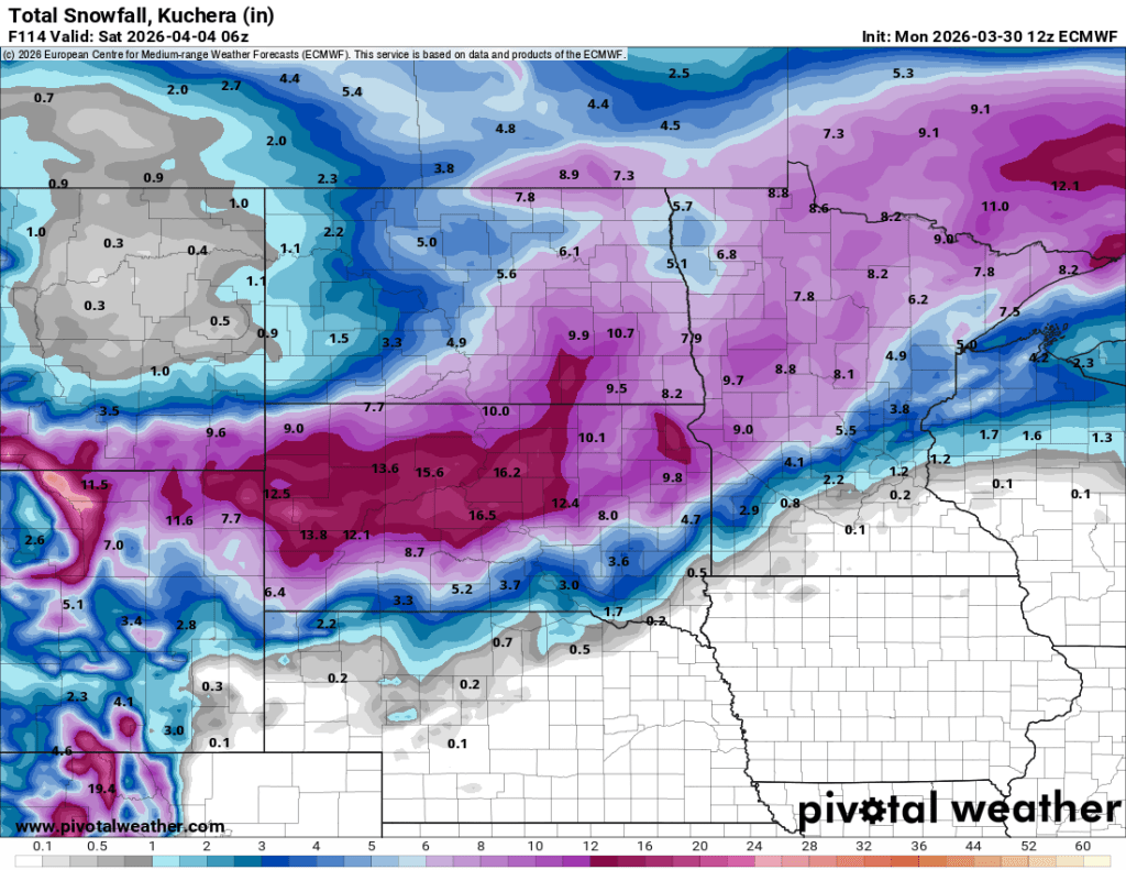
This is a look at our European and Canadian models. Now, models typically tend to OVERFORECAST snow amounts. With that being said, I don’t see areas to the west of the valley picking up 19″ I do foresee 6+” within the Valley and areas west of the valley. The strength and track of this storm will likely change a bit over the next 48 hours so please keep up to date on our forecast. Snow should start on Thursday and last into Friday. A second system will pass to our south Fri/Sat. so the MAIN part of this storm will affect the area Thursday into Friday.