Let’s hope this is winter’s LAST punch. We have 2 storm systems heading our way for the upcoming Easter weekend. Storm #1 will affect the area on Thursday with generally LIGHT snow throughout the area with around 2-4″ before it winds down Thursday evening. Here’s a look at some of our models forecasts for storm #1:
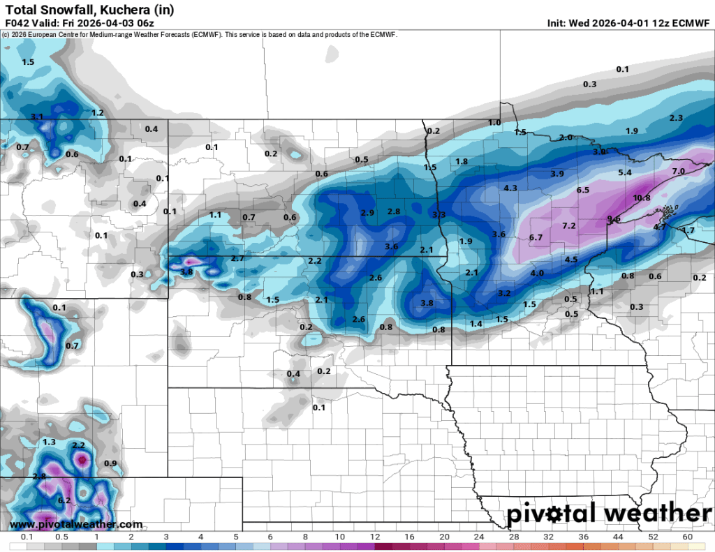
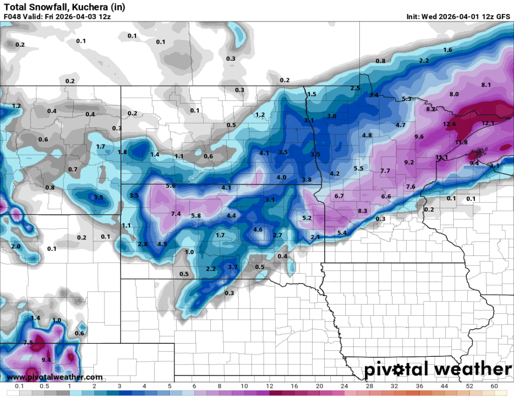
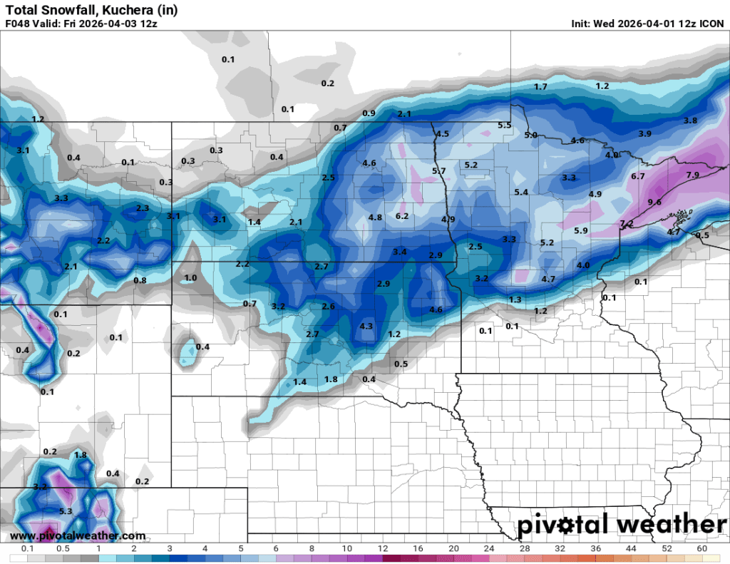
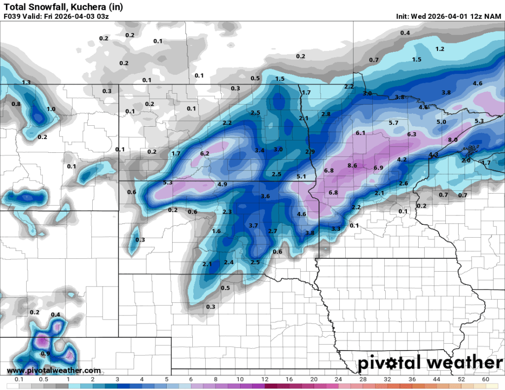

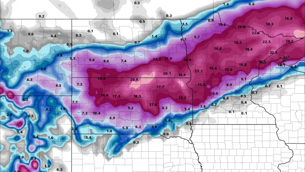
As you see, majority of the F/M area will see 2-4″ with some 5″ amounts possible through Thursday evening. We will see a break in the snow from Thursday night into Friday noon before the 2nd stronger storm pulls out of the Rockies and dumps heavier snow across the area. Here is a look at snow TOTALS from both storms combined ending Saturday afternoon…..my thinking for the F/M area is a GRAND TOTAL of around 7-11″
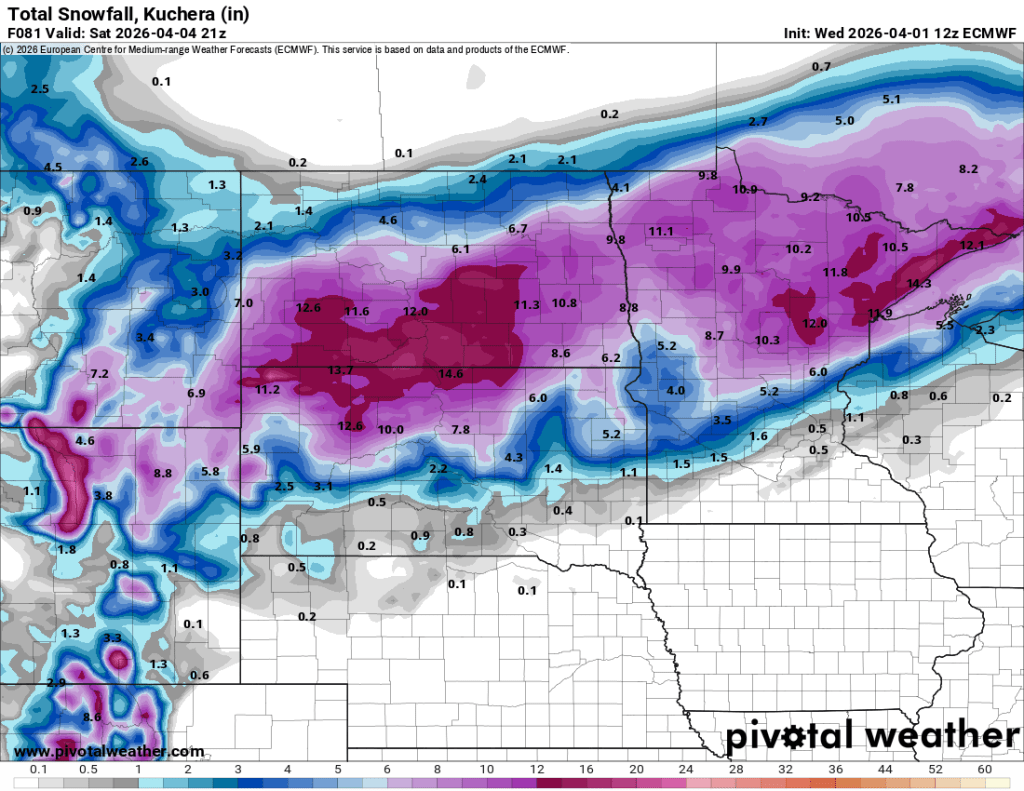
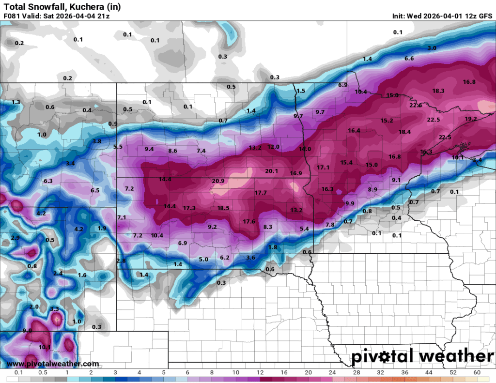
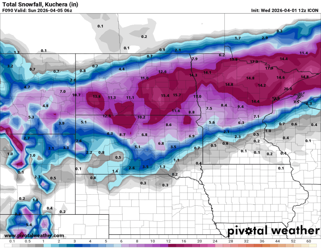
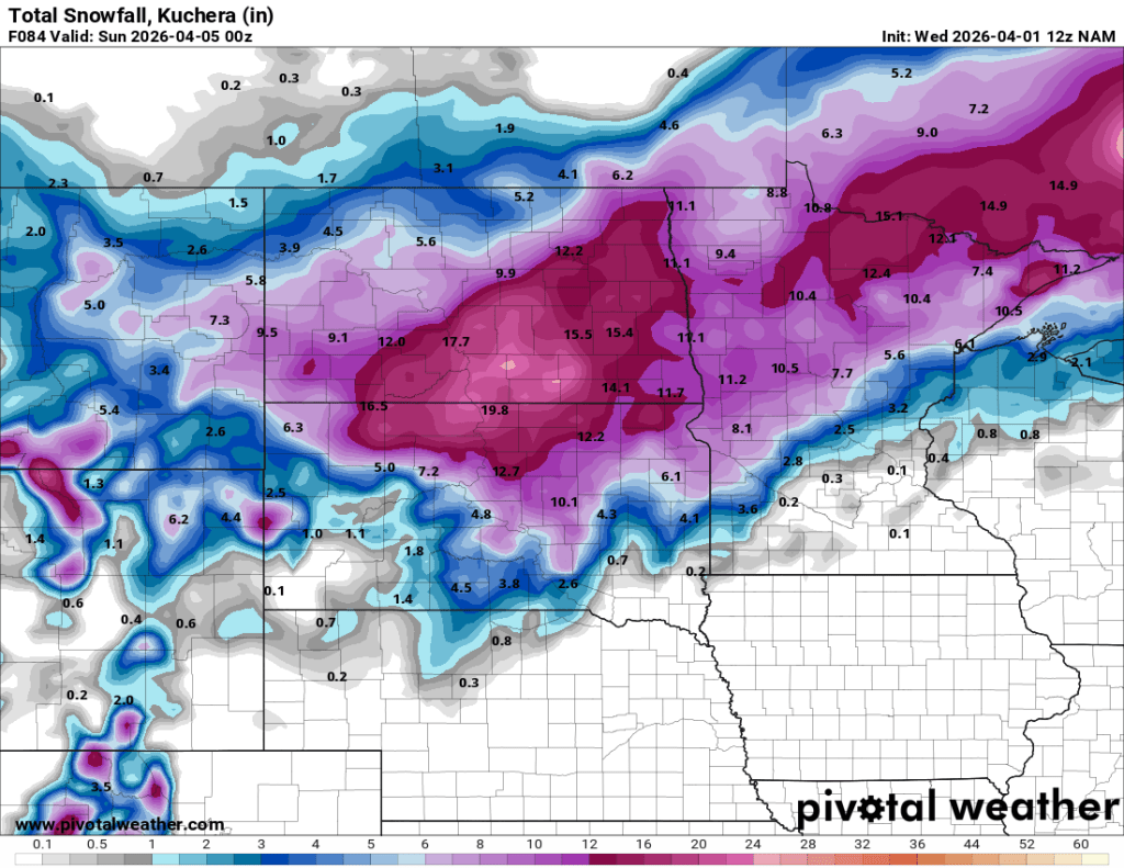
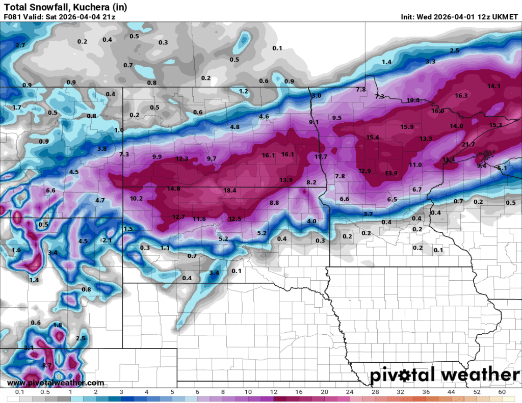
WINTER STORM WATCHES have been issued for the Valley into Lakes Country for Friday afternoon into Saturday afternoon. If you have travel plans, please keep up to date on road condition reports https://travel.dot.nd.gov/ and https://511mn.org/@-96.66821,46.92432,6?show=metroTrafficMap,roadReports,winterDriving,weatherWarningsAreaEvents,stationsAlert,otherStateInfo