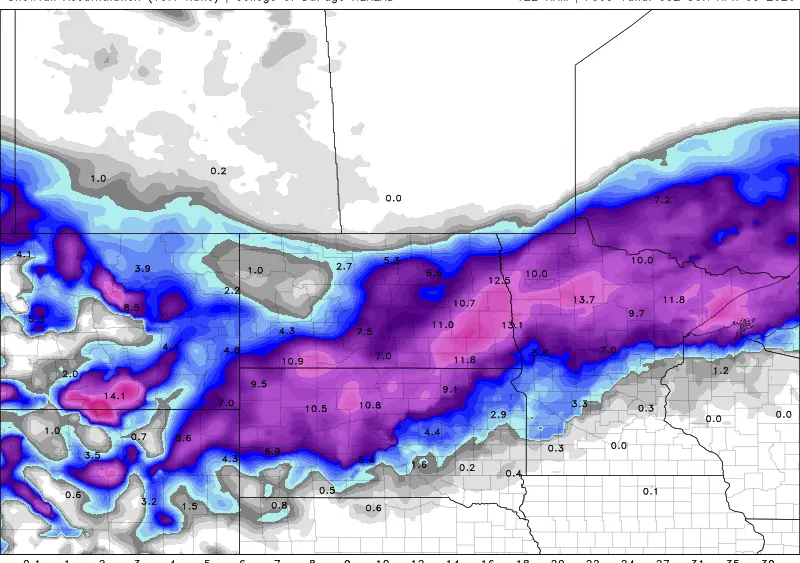
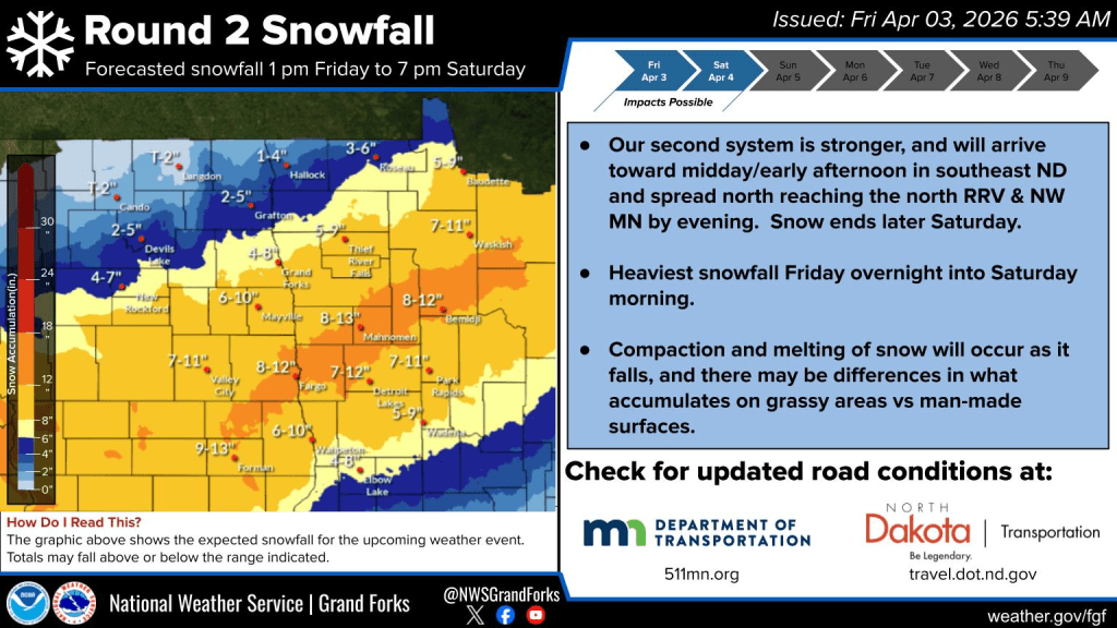
If this storm materializes like I’m expecting it to, this will be the largest storm we’ve seen in the F/M area since Feb 28-March 1st of 2023 when we picked up 9.5″ This storm is unfolding about as expected and it still looks like a swath of heavier snow from around Lisbon through F/M area into Northern Lakes country:
Now, here’s a look at the latest morning models:
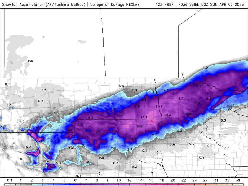
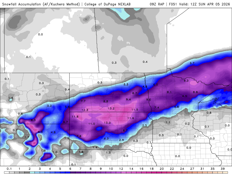
Very similar scenarios which leads to HIGH confidence. Look for snow to overspread the area later this afternoon. Snow will become heavy overnight through mid morning on Saturday before it tapers off in the afternoon. Travel will be VERY difficult on Saturday before improving on Easter Sunday. I’m still leaning toward 7-12″ here in the F/M area.