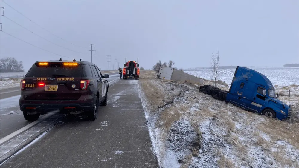
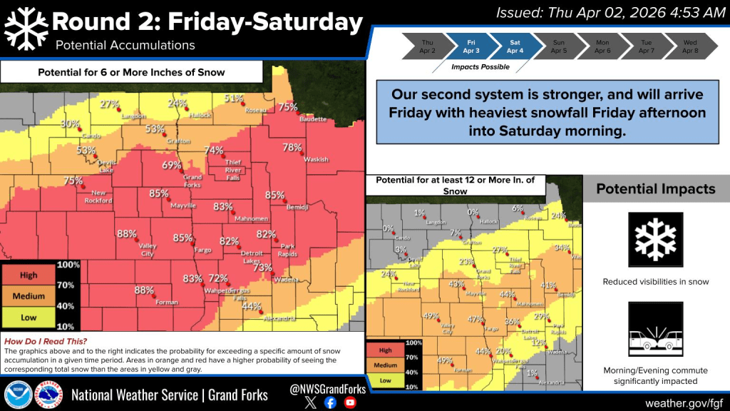
You can’t beat a good spring snow, right??? Round 1 is about to come to an end in the central and southern Valley later this afternoon but continuing snowing in the N. Valley and into NW Minnesota. A general 2-4″ from round 1 is expected. We will see a break in the snow from tonight through Friday noonish. Afterwards, storm #2 will bear down on the N. Plains and produce heavy snow in come locations.
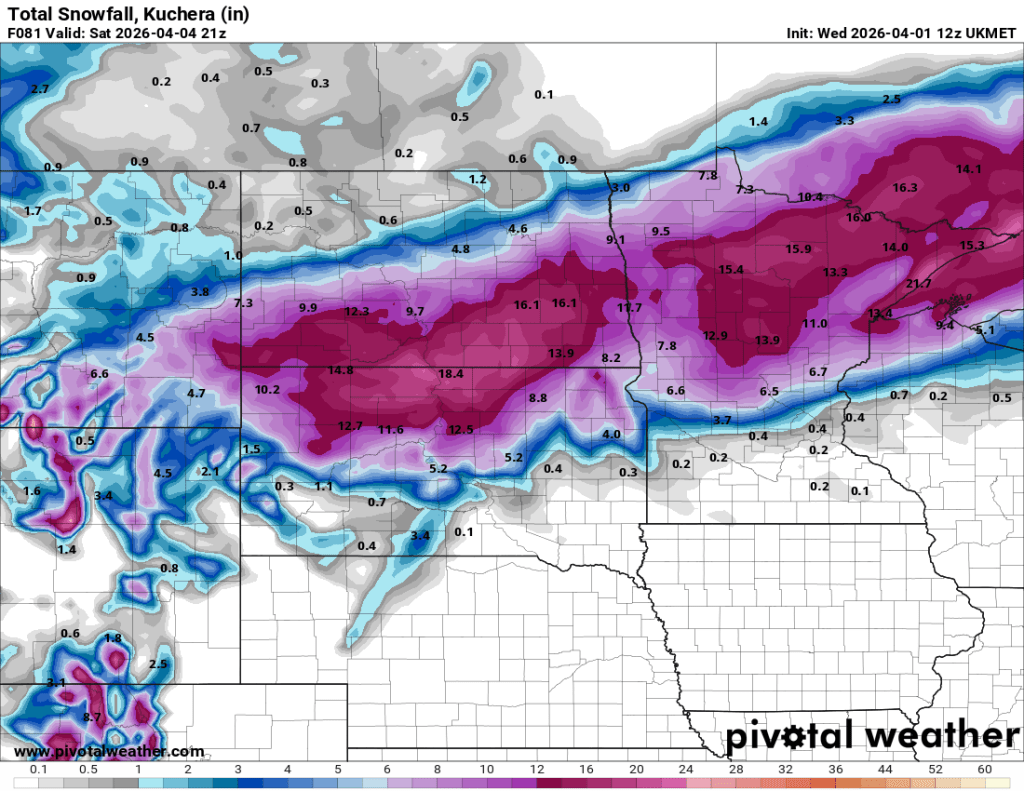
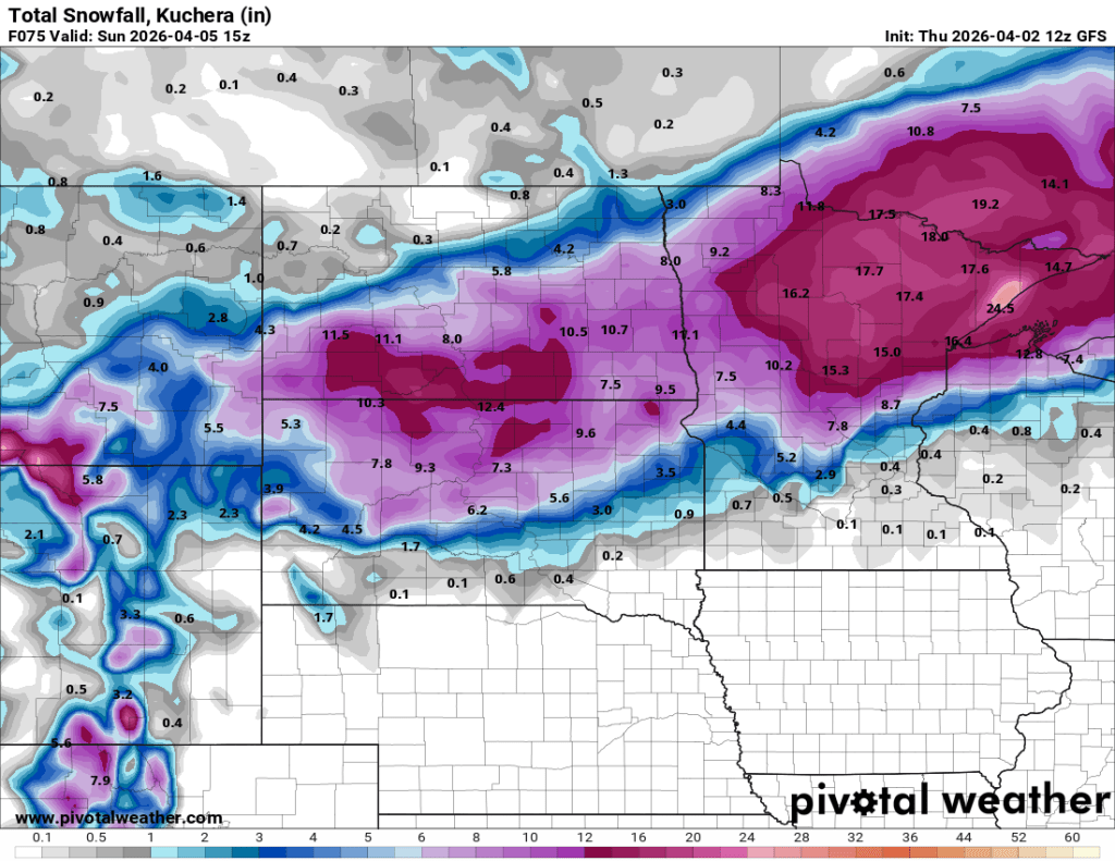
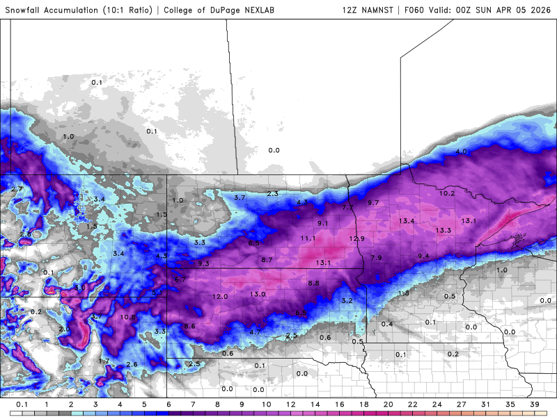
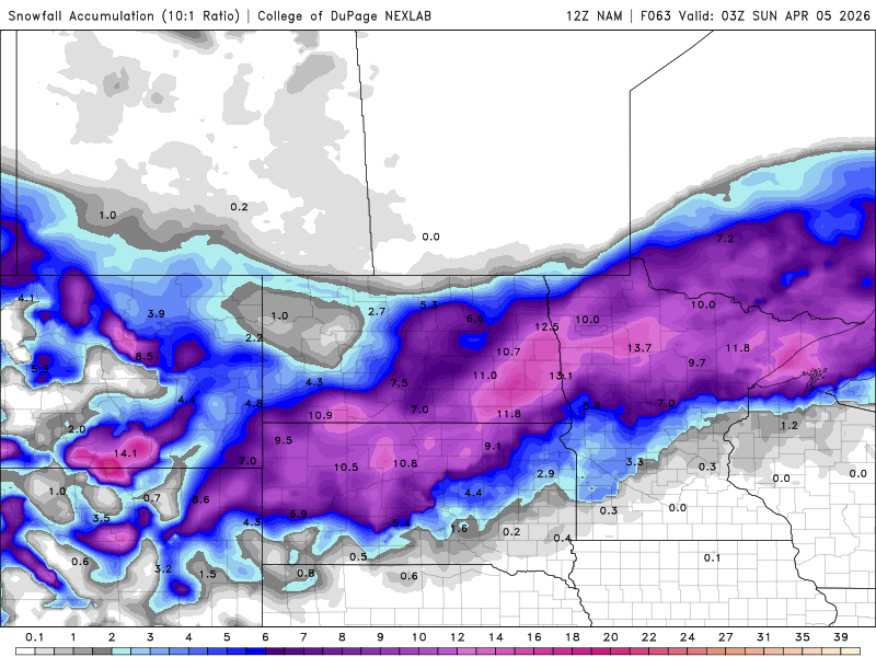
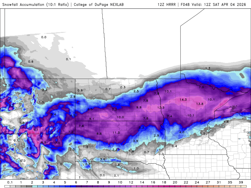
Note, a very high chance of 6+” through the F/M area into Lakes Country. I wouldn’t count on the 12+” scenario. Here’s a look at the latest model guidance for TOTAL SNOWFALL from today’s storm and Fri/Sat storm system:
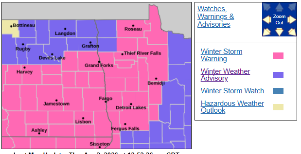
Friday night into Saturday morning will be the WORST part of the 2nd storm coming our way. Current watch/warning map
Total snowfall in the F/M area should top out around 10″ with some locally higher amounts.