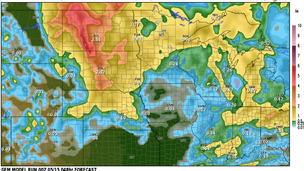
A strong area of low pressure is winding up in South Dakota and will produce rounds of showers/storms today into this evening. Some of the afternoon storms could be on the stronger side, especially into lakes country. Rainfall accumulation across the Valley into Lakes Country will be on the order of 1/2″ to 1″
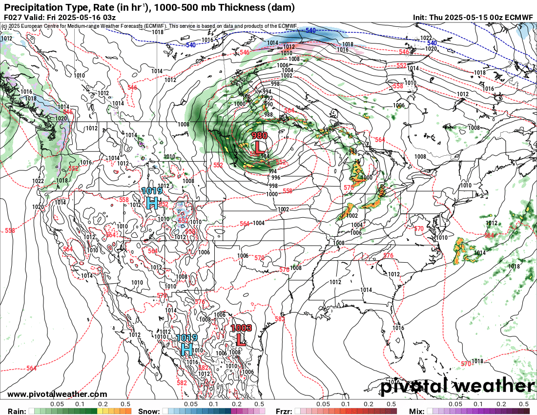
Now as the area of low pressure moves almost directly over the F/M area, precip will start to diminish Thursday night confining all the steadier precip to the west of the Valley:
This storm will sit and spin over our area before exiting to the east on Saturday. Here’s a look at forecasted precip across the area by the time the precip ends on Friday night:
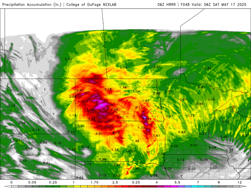
Heavier rainfall will be confined just west of the Valley….unfortunately the Valley into Lakes country will miss out on the heaviest rainfall but 1/2″ to 1″ can be expected.