NO it’s NOT an April Fools joke!! Mother nature is going to give some of us a right AND a left hook over the upcoming Easter weekend. This snow event will come out in 2 parts. Storm #1 will start to affect the area Wed. night through Thursday night. While storm #2 will affect the area Fri-Sat. night. Here’s how our different models are forecasting storm #1:
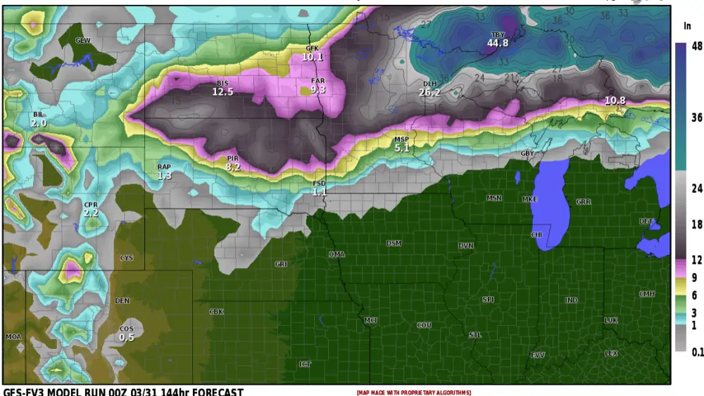
GFS (American Model) Storm #1
ECMWF (European Model) Storm #1
Canadian Model Storm #1
Quite a spread on Storm #1 from Wed. night into Thu. night but consensus is around 3-6″ for the F/M area. Now the second storm will start to impact the area Friday PM into Saturday and here is a look at storm TOTALS from BOTH storms from our different models:
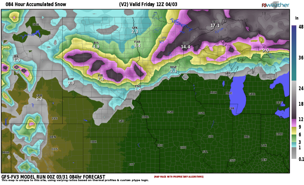
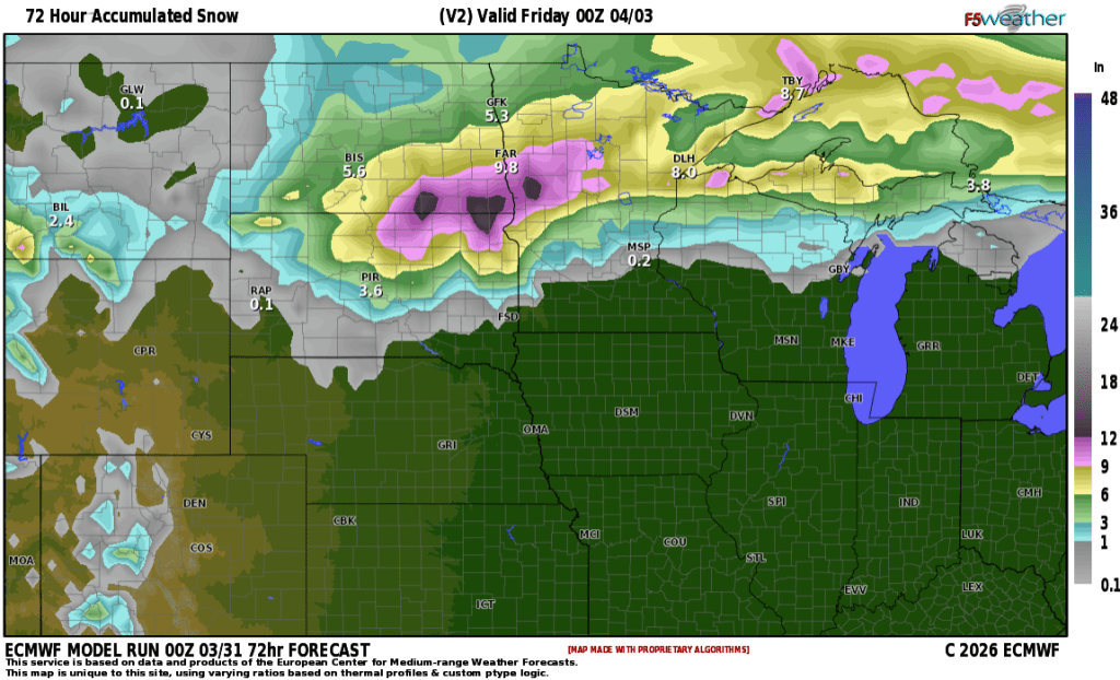
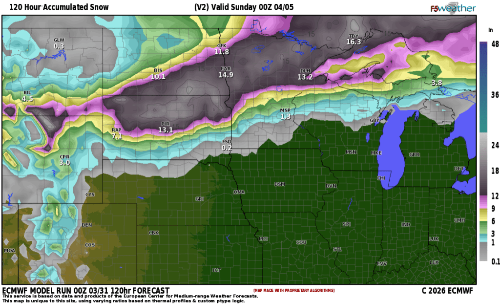
European: Snow totals from BOTH storms
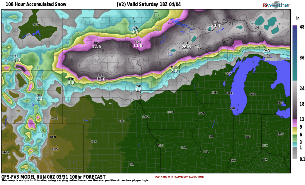
American model snow TOTALS from BOTH storms
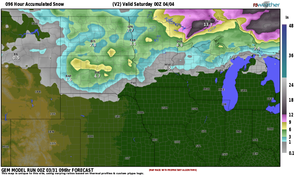
Canadian Model snow totals from BOTH storms:
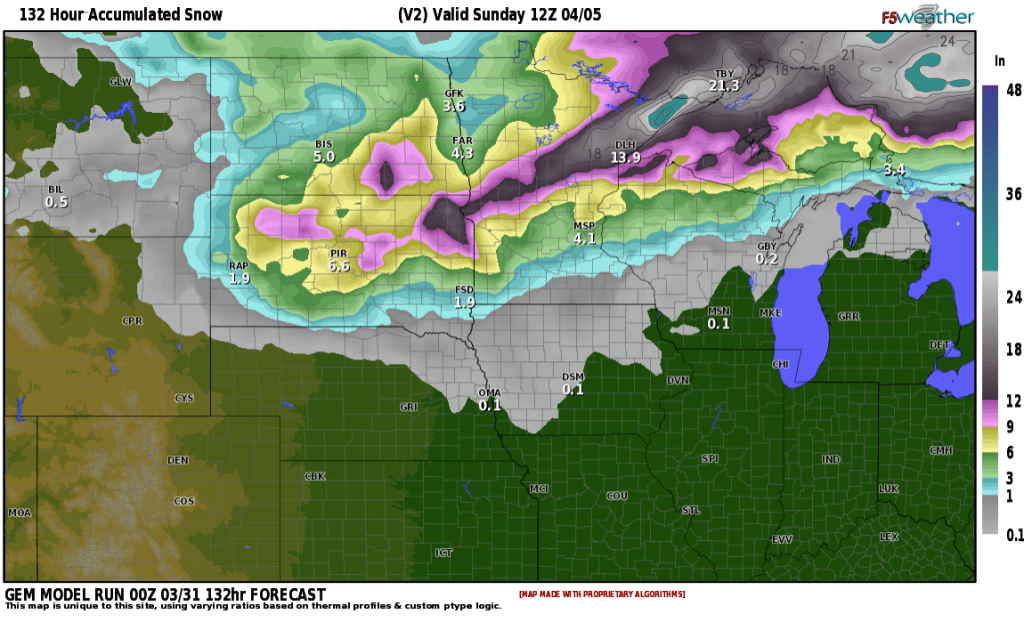
MUCH lighter amounts from the Canadian BUT do you notice the MAIN trend in MOST models?? The HEAVIEST snow is expected to fall to the south of the F/M area.
If you have ANY travel plans throughout the area, please keep up to date on the forecast. Watches/Warnings/Advisories will be issued across MOST of the area for these 2 storms. The GOOD news is as this storm comes at us in 2 pieces, this gives the road crews a better chance to keep ahead of the storm.
Currently, I’m leaning toward 4-8″ TOTAL for the F/M area by Sunday morning.