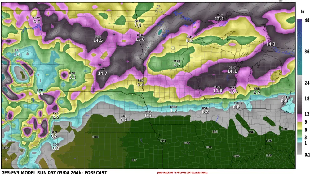
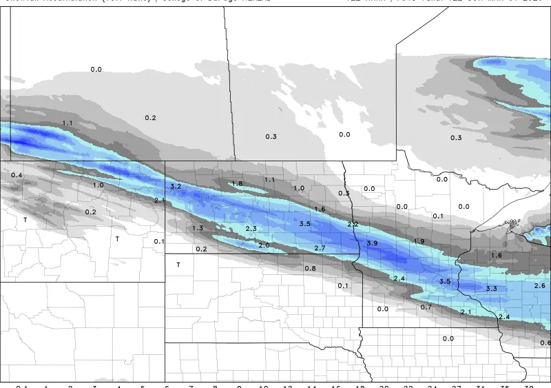
The LRC is cycling right on schedule and outside of a few minor hiccups, it’s been very accurate this summer. Here is a look at what happened this last Christmas and NOW!! Amazing!!! On the left is the forecast for July 16, 2023, at the 500 mb level. On the right is the actual data from December 23, 2022. It was the most energetic part of the pattern, and it is no coincidence that it looks like the summer version showing up now! Now with that being said, the “cool” part of that upper low is about to pull eastward as a heat ridge will be building over the rockies into the Northern Plains. I’m sure you have heard of all the heat in Texas through Arizona, well that heat ridge is the one building northward. After mid month, kiss these 70s to the door as HOT weather will return with temps into the 90s. Could we see our first 100 degree temps of the year mid to end of the month? It sure looks like a possibility. Now with the heat ridge building north, it shouldn’t last too long….1 week…maybe 2 before more seasonal weather pulls in. I’ve also attached expected rainfall from the end of July through the month of August. Notice the heavier rain falling from SD through MN. Let’s enjoy some more summer!!!
Chief Meteorologist,
Dean Wysocki