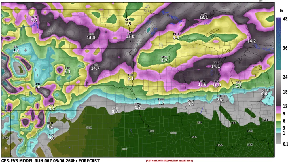
The new LRC cycle has begun and we are watching the first storm in the cycle passing into the upper central portion of the country. This Colorado Low will roll off the Rockies this week and pull into the Northern Plains Thursday and Friday then exit the area and hit areas east on Saturday. The bulk of this storm will be affecting areas south of the I-94 corridor of ND and then central MN but the northern edge of this system is expected to bring in a scattered shower chance on Friday for the Fargo area. Here are a few pictures of the expected path of this storm system.


There is still a 30% chance this storm lifts further north as it has trended over the past week, but more likely to remain on this current track if not even a little further south.
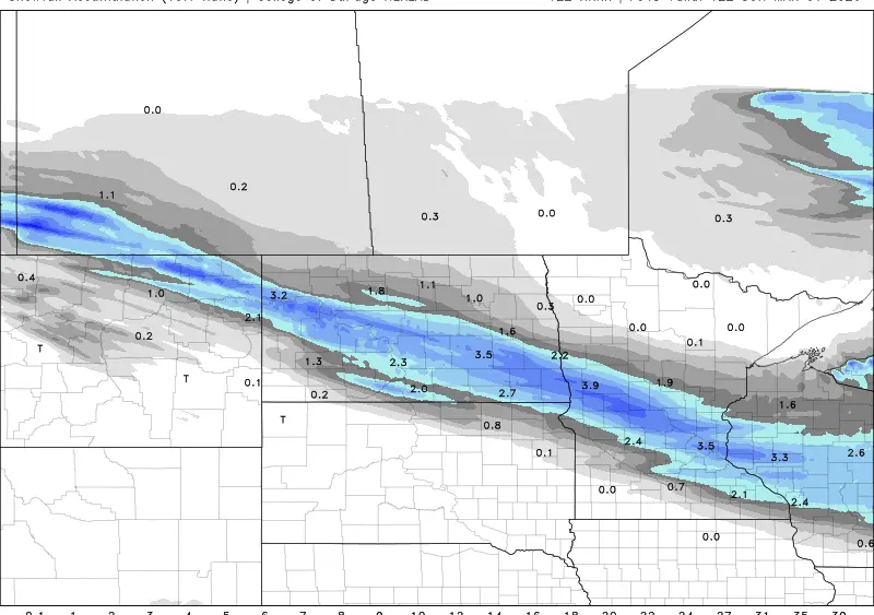
Heavy rains are expected to fall in portions of Nebraska, South Dakota, Minnesota, Iowa, and locations east. Here is a current expected rainfall estimated Forecast via the European model, a likely 1-3 inches of rain.

Strong winds will also accompany this storm system. Here in North Dakota, Minnesota generally 15-30 mph with gusts higher, but locations south may see gusts up to 50+ mph.

We will continue to monitor this storm system but we are more likely to escape most of this at least the excessive wind gusts and heavier rain. It will be interesting when this storm system rolls back around a few more times this winter and into the spring. It will likely be a blizzard maker and severe weather producer in future cycles, likely targeting a similar path.
Meteorologist,
Justin Storm