The 23/24 LRC continues to show its card as we roll deeper into the fall. We are about 11 days into the new cycle and the weather has been pretty good with above average temperatures, but I see changes on the horizon.
Last week contained our first storm of the LRC, it affected areas mainly to our south but we found ourselves on the northwestern edge of the rain, along with the wind. Now storms number two and three are coming into focus. ‘Storm’ number two is currently ongoing, a quick clipper system.


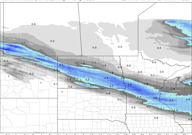
This compact little system is bringing in some breezy conditions along with some areas of rainfall over an inch. Here is the latest NDAWN map of 24-hour Rainfall as of 11:06am 10/18.

Storm number three is more of a shortwave disturbance in the upper levels, but it will still bring in some strong wind along with some showers that will more than likely remain north of Fargo. It is expected to roll through on Friday 10/20/23 from Canada into Minnesota. I expect winds on Friday to kick up out of the northwest on the backside of this little system between 15-30 mph with gusts up to about 40 maybe 45 mph.


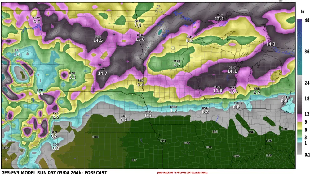
As for the following week, I see changes with cooler weather by the end of the week and another bigger storm system that may target areas of the Northern Plains, Along with that… it could create snow. More on that later as it gets more into focus in the coming days.
Meteorologist,
Justin Storm