The first winter storm has come and gone. Delivering heavy snowfall for a vast area of North Dakota stretching into Minnesota. Amounts between one to two feet of snow blanketed the state with its first measurable snow for the season while over escaped the worst, still seeing trace amounts up to a foot of accumulation. Think about the LRC, ‘this storm’ will roll through a couple more times with a strengthening jet stream. This storm could be a blizzard maker along with a very cold snap of Arctic air.
Winter Storm watches were issued from Montana, across most of North Dakota into northwestern Minnesota ahead of this storm system, which eventually turned into Winter Storm Warnings and Advisories.

This Storm system slowly moved across the Rockies entering western North Dakota on Wednesday and sliding into eastern North Dakota on Thursday then exiting by Friday morning (10/25/23 – 10/27/23).
Here are a couple of the UPPER air maps from the 500 MB level.


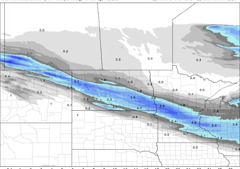
Heavier snow amounts fell across western North Dakota into northeastern North Dakota and northwestern Minnesota. Throughout the southeastern corner of North Dakota and Lakes Country, Minnesota remained mainly rain. A freeze rain/snow transition set up from about Jamestown/Valley City through Hillsboro and through Thief River Falls. Before the turnover to full snow, areas south of the freeze line generally picked up a tenth to about a half inch of rainfall.


Following the storm our first burst of winter temperatures dropped into North Dakota. Temperatures 20-30 degrees below average. BRRRRRR Think about the LRC, ‘this storm’ will roll through a couple more times with a strengthening jet stream. This storm could be a blizzard maker along with a very cold snap of Arctic air. I don’t know when this will occur yet because the LRC hasn’t been set, but I would imagine it would likely return sometime in December weather early or late Dec I’m not sure. As well as the exact placement/track and available moisture.
Meteorologist,
Justin Storm