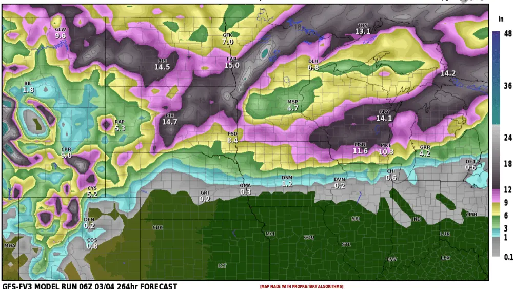
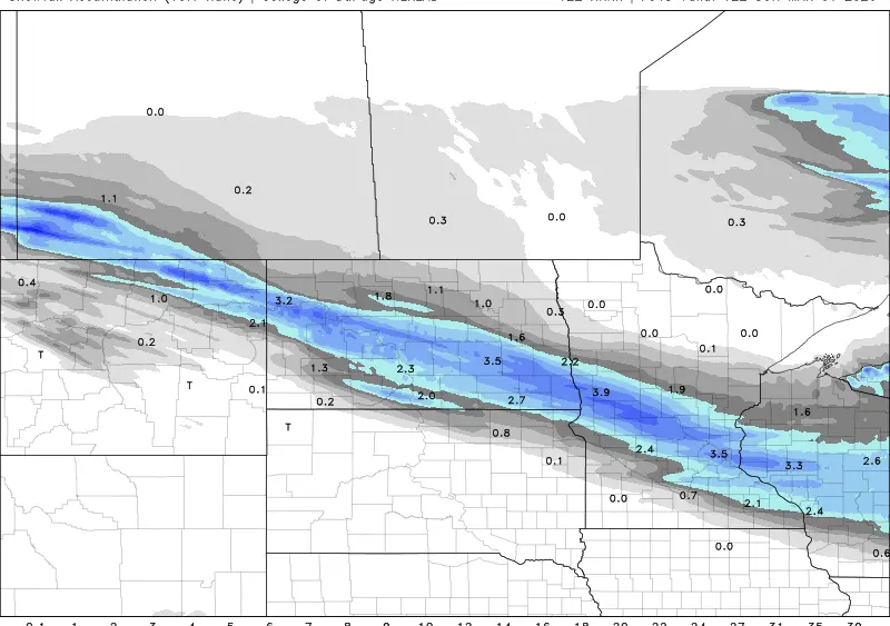
It’s been a QUIET winter for sure but now we go from record breaking warmth to BLIZZARD or NEAR BLIZZARD conditions on Tuesday. The timing on this will coincide with the morning drive into work but conditions will improve for the evening commute home. Normally, the difference between 1″ and 3″ of snow isn’t that big of a deal, however, we will have 45mph wind gusts blowing the snow around in the morning leading to hazardous driving conditions. There will be a sharp cut off in the snow going south of the F/M area so driving conditions won’t be nearly as bad as you head toward the SD border. One thing we look for are “trends” of the models. I’ve attached one model to show one way to forecast. Now, with the first picture, the swath of heaviest snow is situated to the NORTH of the F/M area. In pic 2 the heaviest snow is still NORTH of the F/M area BUT…..notice the trend of the heavier snow sinking south!! If it was just ONE model doing this, you would typically write that scenario off. However, numerous models are shifting the heavier snow southward, closer to the F/M area which sets off alarm bells.
Again, typically the difference between 1-2″ of snow and 2-4″ of snow isn’t THAT big of a deal but with 40+ mph wind gusts expected it makes a HUGE difference. Enjoy today’s 60 degree temps because Tuesday will be MUCH different. Expect a hazardous morning commute! 1-3″ of snow is likely with higher amounts just to the north of the F/M area. IF the models continue the trend of pushing the snow band southward, F/M area may be in on higher amounts and BLIZZARD conditions.
Chief Meteorologist,
Dean Wysocki