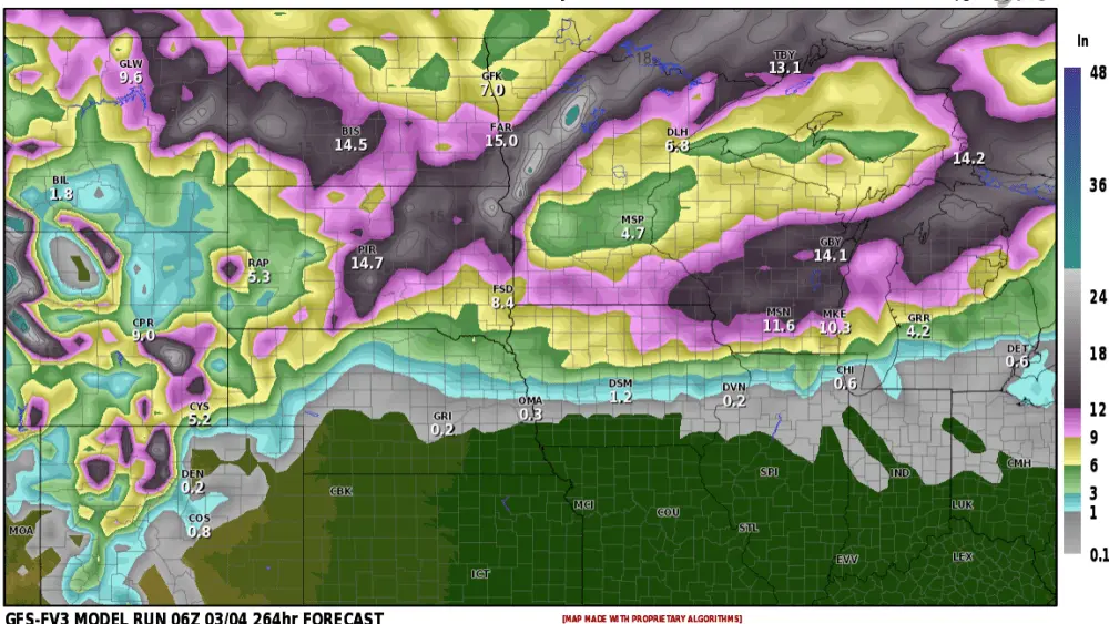
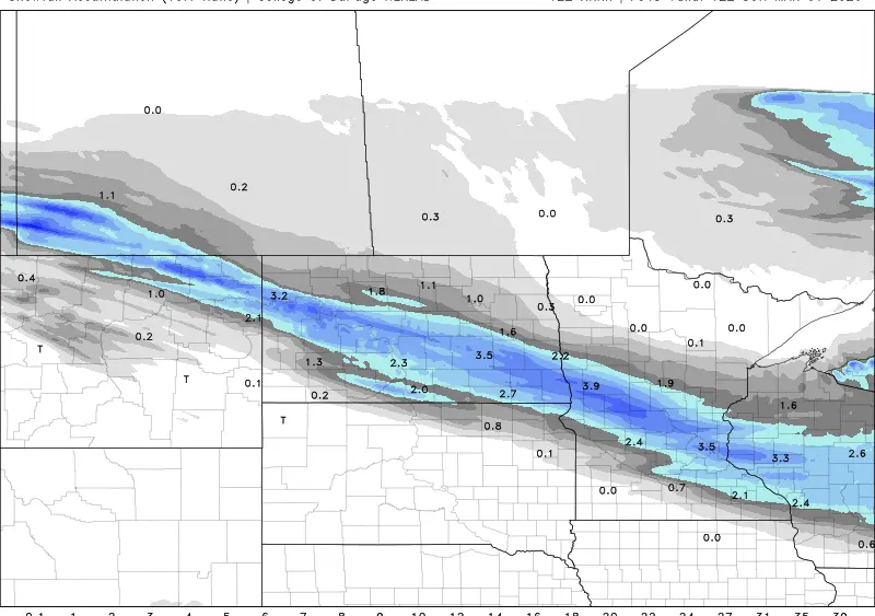
A vigorous Weather System is expected to pull into the Northern Plains at the beginning of next week and stretch into mid-week. Most of the showers and storms look to arrive late Monday through Monday night into Tuesday with showers lasting into Wednesday and possibly Thursday. There is a chance for some snow to mix into this on the back side of the low but a lot of uncertainty still remains with where and how much. Early indications show a good chance for many areas seeing at least a half inch with widespread inch or more. Things will likely change on the exact track of this system so we will continue to monitor it through the weekend and into next week. Especially with the chance for some snow and wind to mix in, which would be more likely out west and southern Canada.
Here are three maps of expected rainfall over the beginning of next week. The European, American GFS, and the NWS Blend of models. As of 4/11/24 12z model runs.


meteorologist,
Justin Storm