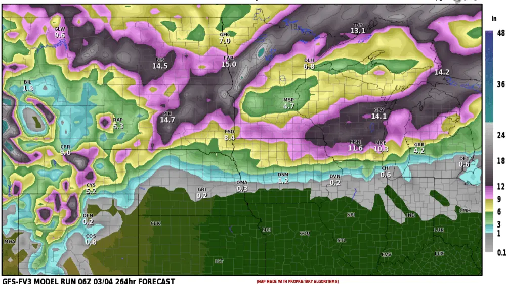
Another Likely chance for Appreciable Moisture comes most of our way to the end of this week into the weekend.
Another low-pressure system will bring a chance for scattered showers overnight Thursday across most of eastern ND becoming widespread rains on Friday. As the storm system lifts further north on Thursday it will bring in windy conditions out of the south between 20-40 mph. Friday looks to be a washout day with rain for most of the day as well as into Friday night. Some breaks are expected on Saturday as rain ‘should’ taper off or become more scattered for the afternoon but still, some showers around the area should be anticipated this far out from the event. Another round of rains looks to head out way on Sunday beginning another round of showers for parts of North Dakota but more into South Dakota and Minnesota on Sunday then exiting the area on Monday.
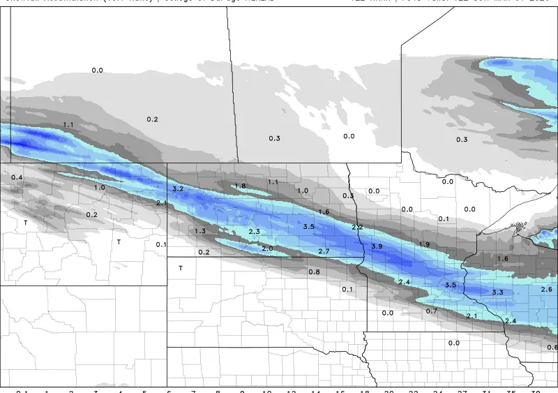
Early indications across this multi-day rain chance show a good probability of getting a half inch of liquid across most of ND with higher amounts in the 1-2 inch range in SD and MN. Although this is early indications over multiple days this is an average or a blend in the most recent model on expected rainfall as of 18z 4/23/24. Do note that it is not likely for things to look exactly like this when all is said and done. It is just an indication or model suggestion on what may happen based on information day, and again an average between all the other models included.
Fargo area Summary.
In short, Thursday will be windy and warm, near 70s. Friday widespread rain for most of the day and cooler 50s, but still breezy. The weekend, Saturday scattered showers trending drier through the afternoon but cool 50s for highs. even cooler on Sunday another chance for rain through the day, more south and east of Fargo likely with temperatures in the 40s to low 50s.
Meteorologist,
Justin Storm