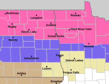
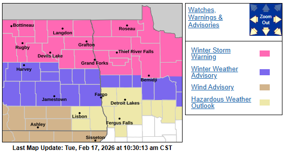
The LRC has been predicting an active 2nd half of February and here we are. Storm #1 will start to impact the area tonight into Wednesday with varying amounts of snow across the region. Winter storm warnings have been issued for areas along and north of Hwy 2 and Winter weather advisories along and just north of the 94 corridor:
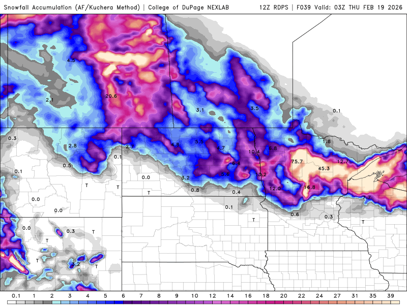
Now, snowfall totals are all over the place but the one consistency among ALL the models are that the heaviest snow will fall along and north of the Hwy. 200 corridor. The BIG question marks are around the 94 corridor and how much snow is expected. There are a lot of questions as to WHEN the transition from rain to snow occurs around the F/M area.
What we look for first off are the “trends” of the models from run to run. Last night’s model runs were trending the track of the storm just a bit south of the previous track. How does that effect the F/M area?? Well it brings the transition from rain to snow into the area a bit quicker and increases our snowfall totals. This morning’s computer runs continue that trend of a slightly “southward” track. This means slightly higher amounts of snow expected in the F/M area. There will be a SHARP cutoff in snowfall totals from north to south.
Here’s a look at snowfall totals from various models and there is a WIDE variety of solutions:
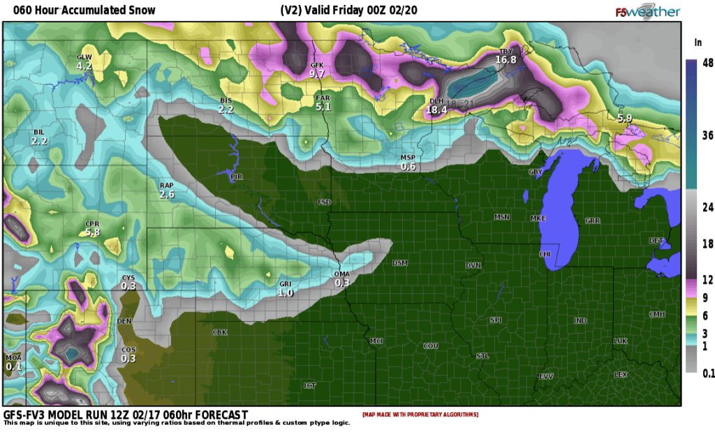
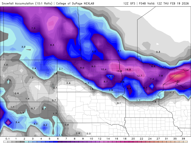
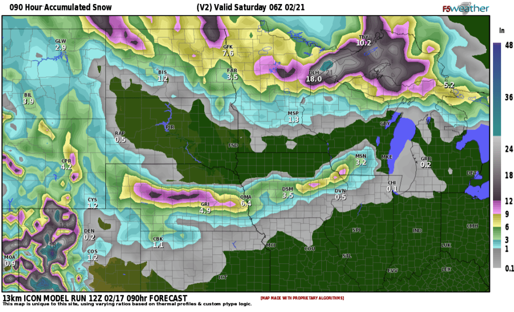
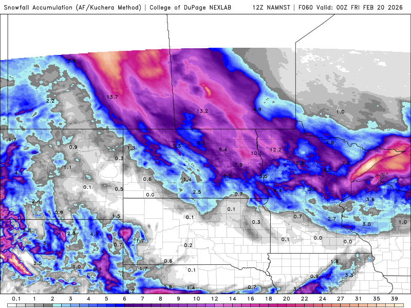
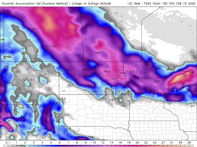
NOW, some of these snowfall predictions by the models are RIDICULOUS!! 9-13″ for the F/M area?? NO CHANCE!!! But WHY would some models be predicting such high snowfall totals?? It all has to do with different mathematical equations put into different models, different track of the storm compared to another model. Many different things effect snowfall totals. With that being said SNOWFALL prediction is one of the hardest forecasts to nail down in meteorology. Why??? Well, you can see why with the above examples. Another example, if we forecast 3/4″ of rain opposed to .10″ of rain, nobody would blink an eye. However, when you translate that to SNOW, using a 10:1 ratio, that would be anywhere from 1 -7″ and that makes a HUGE difference when it comes to travel.
With all that being said, many things are coming into play into the snow forecast for the F/M area. We are “on the fence” of a light snow accumulation to a more moderate accumulation with the HEAVIEST snow for sure being confined to the north. All in all, I believe that the F/M area will fall somewhere between 3-6″ with lighter amounts to the south and southeast and heavier amounts (6-10″) to the north. The worst part of the storm for the F/M area will be between 7am Wednesday and 5pm Wednesday. Winds will increase throughout the day Wednesday so blowing snow will be an issue especially in the north as the snow will be of “drier” consistency. Please keep up to date on the forecast if you have any travel plans on Wednesday. If you have any questions, feel free to email me at weather@flagfamily.com.