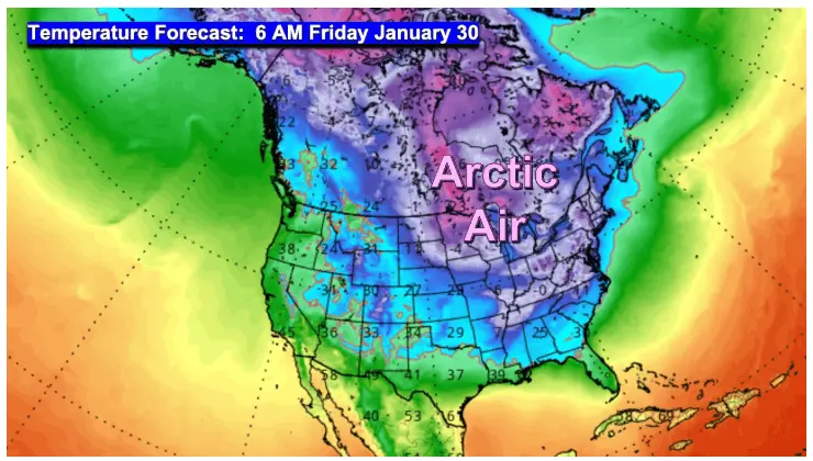
More Arctic air will grip the region through the rest of the week. Temperatures will remain in the single digits for highs and nighttime lows well below zero. However, there does appear to be a pattern change as we go into a more “active” part of the LRC cycle. The upcoming part of the LRC cycle pushes the Arctic air back north:
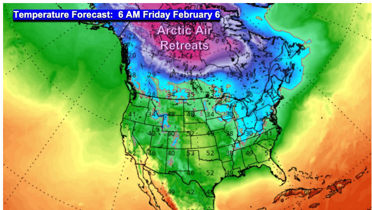
20s and 30s are forecasted to move back into the area the first week in February. However, as we “warm up” the storm track becomes more active. One clipper system will move our way this weekend with a round of snow Saturday night into Sunday morning. Here’s a look at potential accumulation:
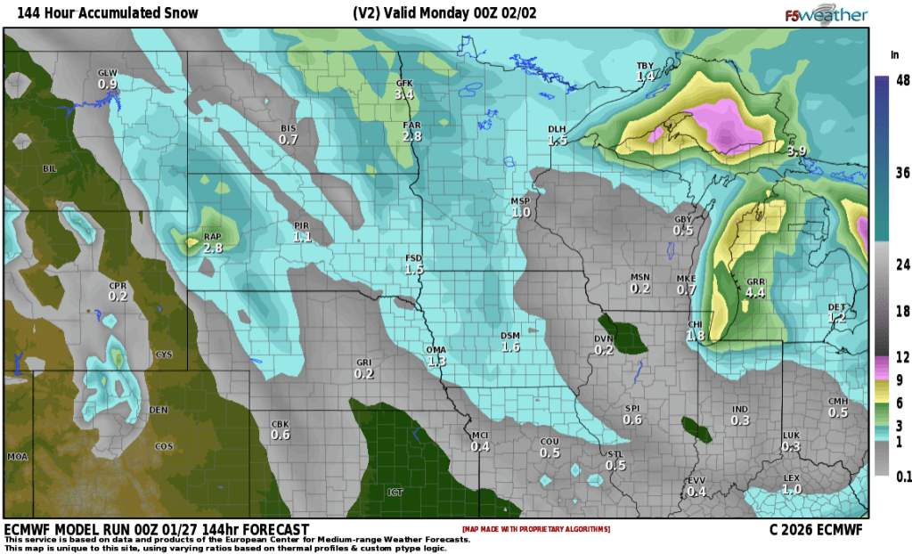
1-2″ are likely with some areas picking up close to 3″ LRC is forecasting an active pattern the month of February:
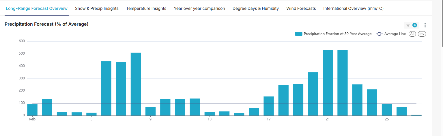
Notice the “spike” in precip from 6th through the 12th then again the 17th through the 24th. Now it doesn’t mean it will snow EVERY one of those days but these are the “target” dates for potential bigger storm systems. Note: this is based on an approx. 73 day cycle. Days may fluctuate by a day or so. If you are a snow lover, February may be your month you have been waiting for. Stay tuned…..