Our mild weather will continue into the upcoming weekend with near record warmth on Saturday!! A BEAuuuuutiful weekend with temps remaining about 20+ degrees above normal this weekend into early next week. Then….a pattern change will bring stormier weather to the area for the 2nd half of the month. Storm #1 arrives next week and will bring snow to the area.
There are a couple of “wild cards” with this storm.
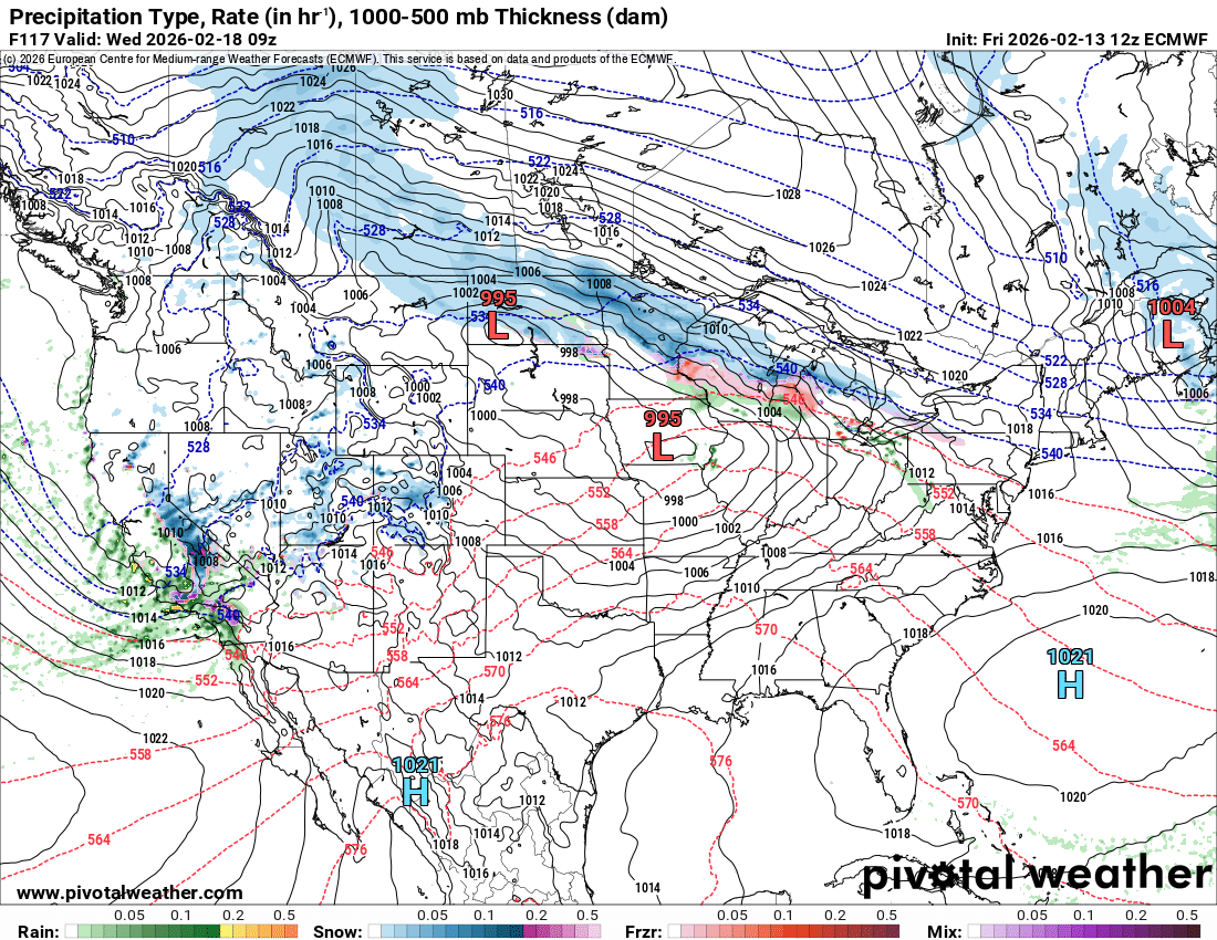
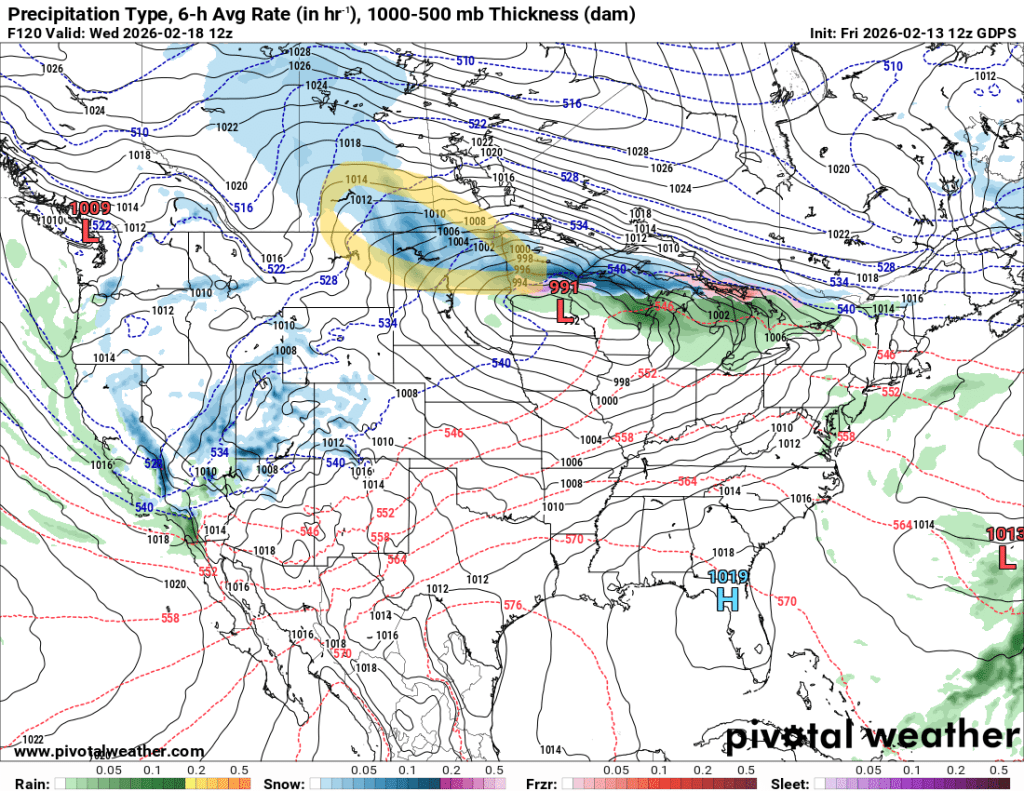
Wild card #1 is the storm comes at us in 2 pieces:
If this scenario occurs, snowfall would be lighter, probably on the order of 2-3″ Tuesday night into Wednesday
Wild card #2 scenario is the storm comes out in ONE piece and gives us heavier snow:
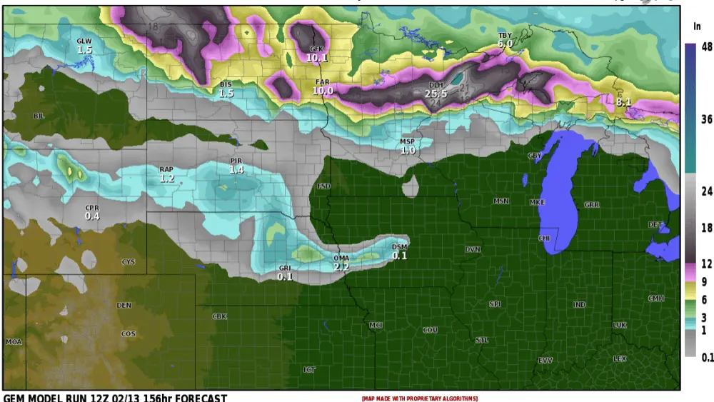
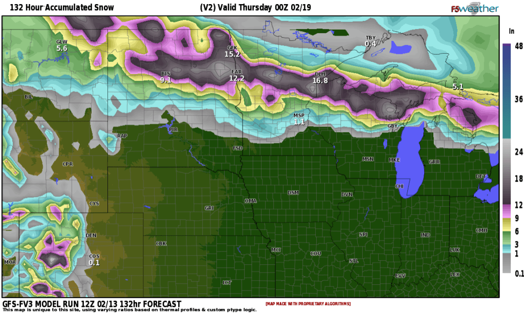
This would give heavier snow on the NW part of the storm (North Dakota into MN) with a TROWEL event setting up (area highlighted in yellow). What in the WORLD is a trowel event? Here’s a good explanation:
A TROWAL (TROugh of Warm Air ALoft) is a narrow zone of warm, moist air forced upward and wrapped around the north/northwest side of a mature, area of low pressure
it indicates areas of intense lift and frontogenesis, typically leading to heavy snowfall. TROWALs are responsible for some of the heaviest snowfall, as they signify where the warm conveyor belt of a storm wraps back around the surface low. However, If a TROWAL shifts, it can significantly alter snowfall projections. Here is a look at snowfall projections assuming a “trowel” event unfolds:
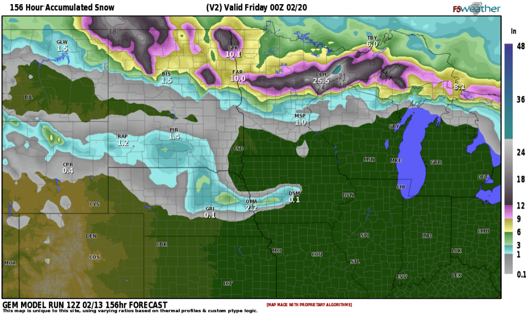
Now, if the “2 part” scenario unfolds, snowfall will be something like this:
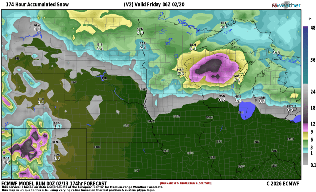
As you can see, a BIG difference in regards to snowfall. I’ll be ironing out the details over the weekend into early next week. If you have travel plans around Wednesday next week, please stay up to date on the forecast.