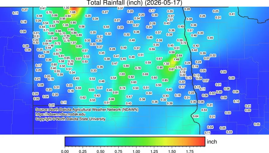
A beneficial rain for some on Sunday provided some much needed moisture, however, not EVERYONE saw the beneficial moisture:

F/M area only picked up .13″ while lakes country saw hardly anything at all. Note the banding of the rain just to the NW of the F/M area where areas around Hope and Pillsbury picked up well over 1″ of rainfall. Unfortunately, the widespread rainfall didn’t occur into lakes country and across the southern valley.
There is another storm heading our way Monday night brining more rain. Here’s a look at our latest model’s projected rainfall for Monday night:
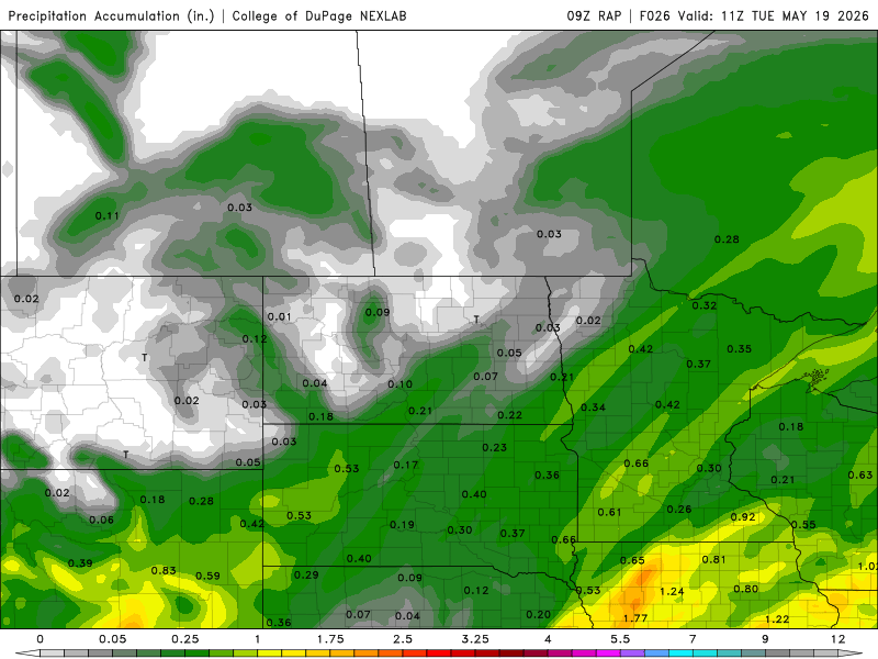
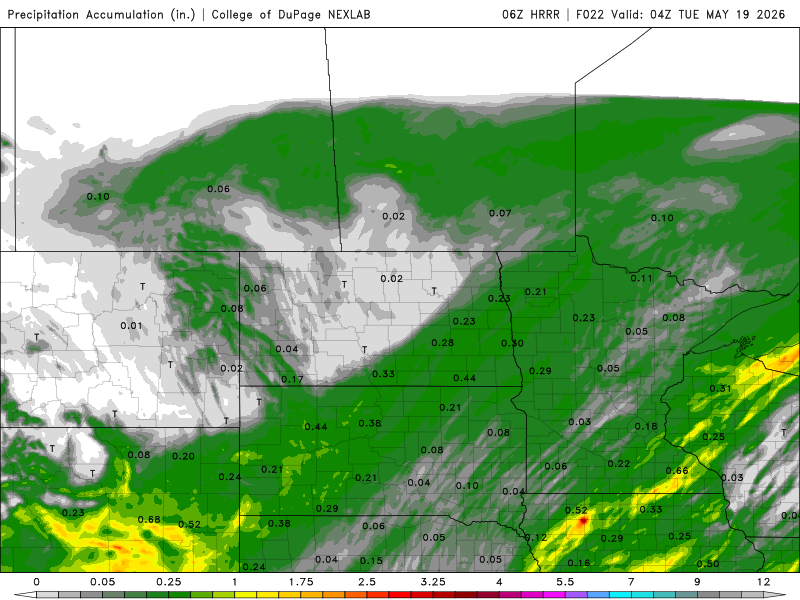
It looks like around an additional .25″ of rain across the area. Not as much as we’d like but we will take anything we can get at this point. After Monday night’s storm system departs, there IS a chance for FROST on Wednesday morning as temps dip close to the freezing mark. Afterwards, there will be another system coming our way at the end of the week before a nice mild Memorial Day Weekend sets in with highs in the 70s to low 80s.