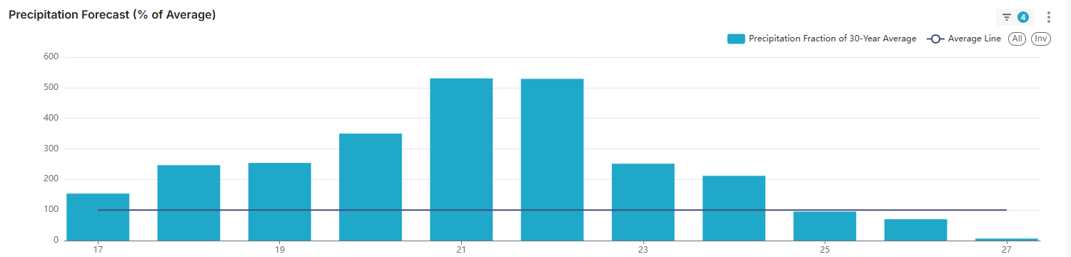
Where’s all the snow?? That’s what our snow lovers are asking!! So far this winter season, we’ve picked up 19.5″ of snow. That’s 12+” BELOW AVERAGE!!!! This is reminding me of last winter with our “snow drought” However, hang tight snow lovers as we are about to go into the “stormy” part of the LRC cycle with 2-3 storm systems moving our way. Below is the graph indicating storm “potential” starting next week. Notice how precipitation average shoots up to 500% of normal!!!
One of the storms late next week COULD be a big one and it aligns perfectly with the LRC. Take a look at one of our model’s outlook for late next week:
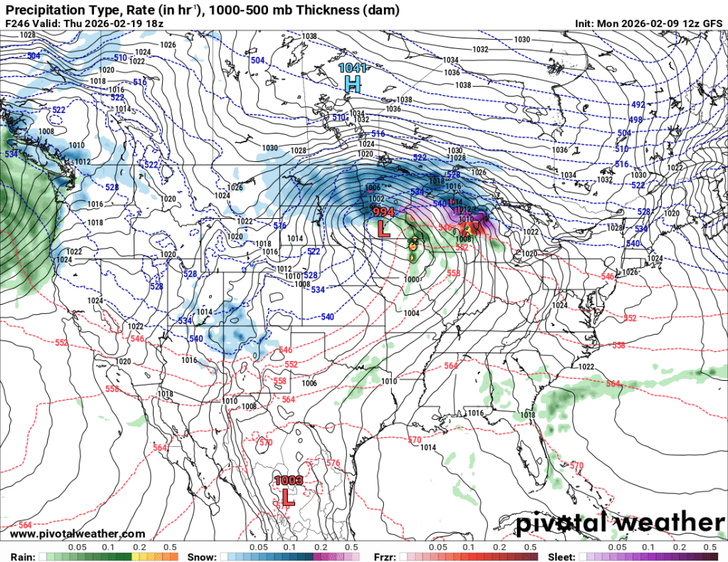
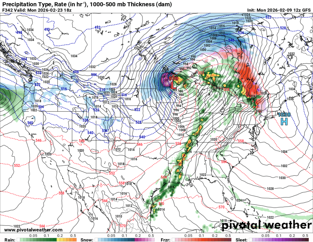
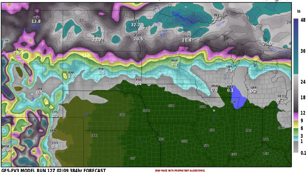
IF this verifies and that’s a BIG if….we would have back to back BIG storms from the 19th – 23rd. Now, the track of the storm AND the amounts of snow WILL change between now and next week, but this gives us a first glimpse on what MAY be coming our way. Some pretty impressive snowfall totals for sure:
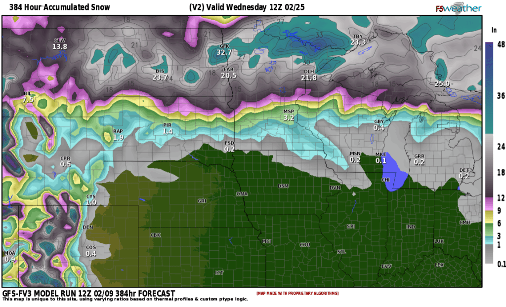
Just to compare, yesterday’s models were only giving the F/M area about 3-4″ of snow. Needless to say, we will be keeping a CLOSE eye on next week into the end of the month. The LRC has been predicting this for months so let’s see how this pans out. Stay tuned…..