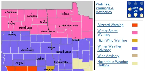
Snow will continue to wrap around an area of low pressure through the rest of today into tonight. Snow will vary in intensity with a steady band of snow on the back side of this storm from Jamestown to Aberdeen producing blizzard conditions in the Aberdeen area today. That band of heavier snow will push toward the F/M area in a weakening phase as we head into the afternoon.
Snowfall across the area has ranged from around 2″ as of 10am in the F/M area to 3-5″ in Grand Forks, 6+” in NW Minnesota where travel is not recommended this afternoon. Here’s a look at additional snowfall expected across the area:
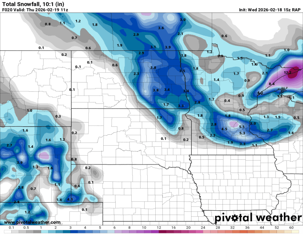
An additional 2-4″ expected through tonight. So, not a blockbuster storm but enough to cause some travel headaches. After today’s snow event, only a few leftover snow showers on Thursday with colder 20s then even colder weather for the weekend with highs in the teens and lows 0 to -5. Our next chance of snow appears next Tuesday and looks to be a minor event.