Near record heat is heading our way for Mother’s Day into early next week.
Sunday’s record: 93 (1906)
Monday’s record: 96 (1900)
Highs both Sunday and Monday are expected to be in the low 90’s with WINDY conditions out of the south gusting 40+ mph. Above normal temps continue through early next week, then a storm system riding out of the rockies will bring us showers/storms by midweek and some of those storms could be on the strong side. Here’s a look at a few of our models prediction for rainfall the next 10 days:
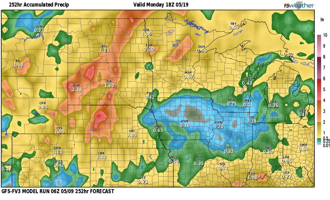
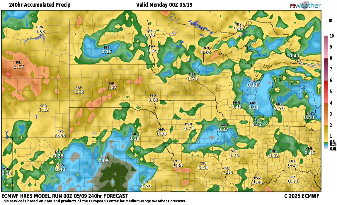
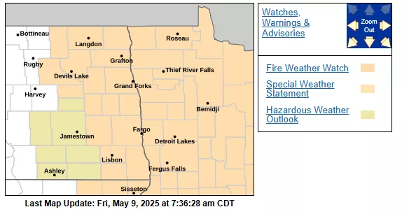
Quite a difference in models in regards to how much precip across the state. It all depends where the lines of storms develop later next week and another storm following that one. Enjoy this weekend with HOT temps but unfortunately a high fire risk comes with that with STRONG southerly winds.