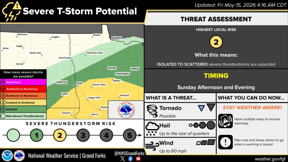
2 storm systems will affect the area through Tuesday. Storm system #1 is pushing in from the south this Sunday morning providing a steady rain from Jamestown through Medina. Scattered showers will continue to develop to the south of the F/M area and push north throughout the day. Showers will increase in coverage after 2pm and become more numerous toward evening. Some strong storms are possible south of the F/M area into Lakes country and toward the MSP area.
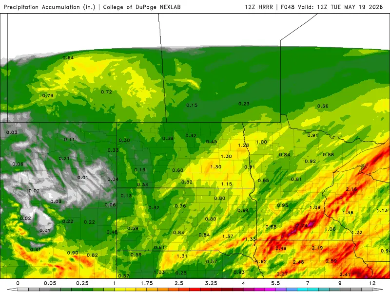
I’m not anticipating HEAVY rain from these two storm systems BUT the precip will add up to about 1/2″ to 1″ across much of the area. Here is a “snapshot” of this morning’s models prediction through TUESDAY morning:

This is the outlook through TUESDAY with both storms impacting the area. I’m not totally sold on the “higher” amounts in the F/M area. It all depends on how much moisture gets “robbed” coming northward by thunderstorms that develop well to our south and a “dry slot” of the storm that will quickly punch into the area toward sunset. Still expecting a good widespread rain across most of the area, just a little less than what the models are forecasting for our area.
Afterwards, chilly air will pull into the area for the 1st half of the week with 50s for highs and 30s for lows. Yes, unfortunately, we may see frost on Wednesday morning so be prepared. Let’s pray for a good soaking of rain for our AG community with these 2 storms.