We have a major storm system heading our way and some areas will get hit with 12+” of snow while others (along and N. of Hwy 2) get spared for the most part. It’s a complex storm and there’s many things to look at, so let’s dive in.
An area of low pressure is developing in SE Colorado

As the area of low pressure strengthens, it will move northeastward toward MSP by Tuesday morning

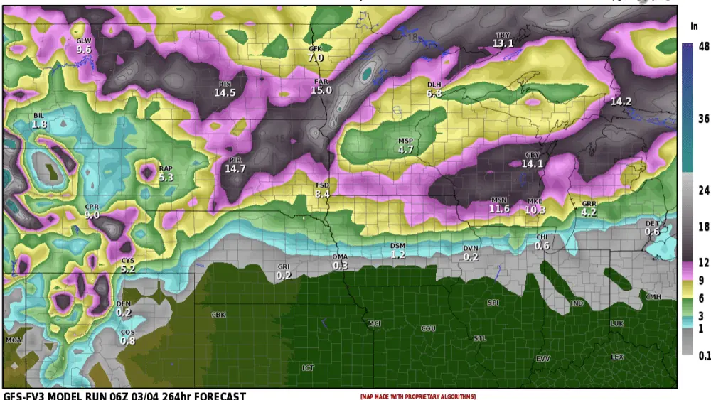
Now let’s take a look at snowfall POTENTIAL, first the RAP model which is painting anywhere from 6 to 8″ across the F/M area with lesser amounts in the northern valley and higher amounts centered on Lakes Country where 12-20″ are possible

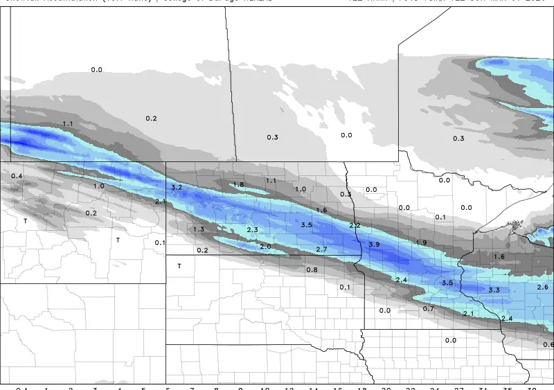
Now let’s take a look at our UKMET model:

This model is a bit more aggressive with the snow in the F/M area with higher amounts to the S and SE.
Summary: This storm will be an absolute mess for the central and southern Valley into Lakes country. The highest snowfall totals WILL be in lakes country. But, with that being said, even if the F/M area comes in on the lower end of snowfall (5″) when you combine that with 25 to 45mph winds, BLIZZARD or near BLIZZARD conditions will occur during the day on Monday. The snow will start to wind down Monday night BUT the winds will remain STRONG through Tuesday morning causing considerable blowing and drifting snow. Expect road closures to occur on Monday and probably last into Tuesday.
Snowfall expectations: Fargo/Moorhead: 5-9″
Grand Forks: 2-4″
Whapeton : 6-13″
Det. Lakes: 9-16″