Mother nature is fighting us over spring and summer warmth then much cooler weather. Wednesday will feel more like summer with temps soaring into the upper 80s:
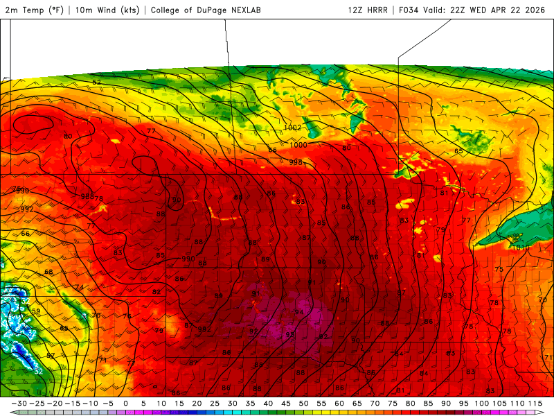
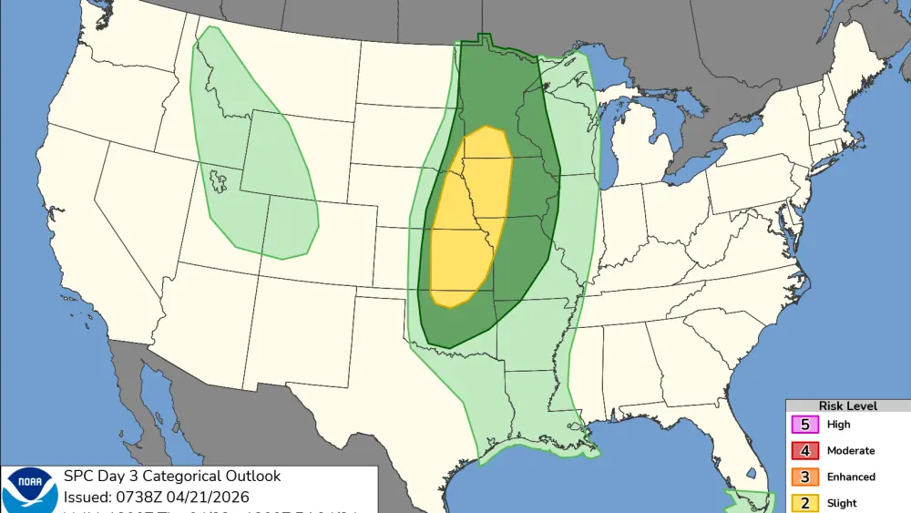
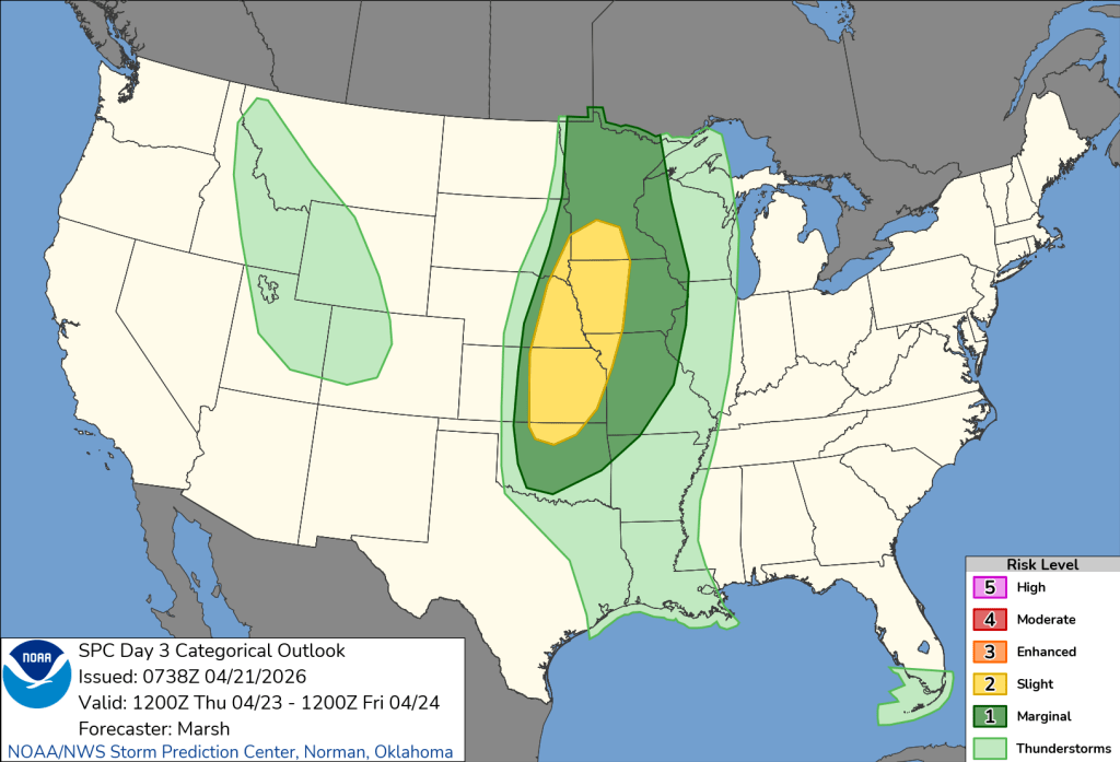
Our short term models are predicting around 88!!! The record is 89 set back in 1990 and I think we have a chance for tying that record. Following near record heat, a strong cold front will be pushing in from the west. As it moves into the Valley and lakes country, scattered storms will develop on Wednesday night but Thursday we may see some strong to severe storms. I believe the best chance will reside to the east of the Valley where a slight risk of severe storms is possible:
After that cold front passes, much cooler weather in the upper 40s to low 50s for Fri/Sat before a chance of rain comes into the area on Sunday. Not the best looking weekends coming up so get out and enjoy the next few days of summer warmth!!!