This year’s weather pattern has been as unique as they come. The atmosphere is cycling according to the Lezak Recurring Cycle (LRC), and it continues to stay remarkably on schedule. When we say “unique,” we truly mean it — this year’s pattern is unlike any other year we have analyzed. From dramatic temperature swings to major pattern shifts, the atmosphere has delivered one wild ride, and there are increasing signs that another major swing may develop within the next two weeks. We will break that down in today’s report.
First, let’s begin with the growing global buzz surrounding the possibility of a “Super El Niño.” El Niño refers to the warming of the tropical Pacific Ocean, but for conditions to officially qualify as an El Niño, we must first see five overlapping three-month averages of +0.5°C above average or warmer. Right now, we remain in a neutral phase — transitioning away from last winter’s La Niña while monitoring the gradual evolution toward what many forecast models suggest could become a strengthening El Niño by late fall and early winter. The key takeaway: El Niño is not here yet, but the trend is developing, and many around the world are watching closely to see just how strong this warming cycle may become. We can begin to see that trend developing on this next slide:
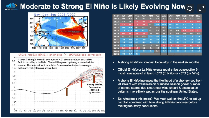
If El Niño does strengthen into a major event, what could that mean for where you live? In general, a stronger El Niño tends to enhance the subtropical jet stream, often increasing storm energy across portions of the southern United States while also creating the potential for split flow aloft during the winter season. This can influence storm tracks, precipitation patterns, temperature trends, and even severe weather zones. However, while El Niño is an important global climate driver, its impacts are not the full story.
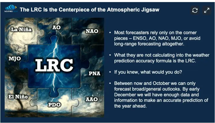
The bigger story lies in the LRC — the centerpiece of the atmospheric jigsaw puzzle. While El Niño may help shape the broader background environment, the LRC focuses on the unique atmospheric pattern that cycling this year and how that specific pattern is likely to continue, and keep driving the real-world weather outcomes where you live. In other words, El Niño may load the gun, but the LRC often helps reveal when, where, and how the trigger gets pulled. That is why understanding both is so important. Over the next few months, we will go much deeper into how a developing El Niño may interact with this year’s evolving LRC pattern and what that could mean for winter ahead.
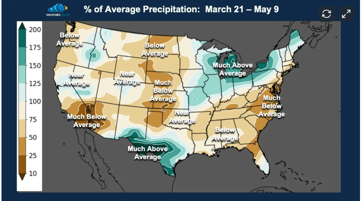
Now, we are FINALLY into more of a spring pattern with stormier conditions for some. Over the past six weeks, these evolving precipitation patterns have helped reshape drought conditions, improve soil moisture in some areas, and increase saturation in others. Here is a closer look at how spring precipitation has been distributed across the country during the past six weeks:
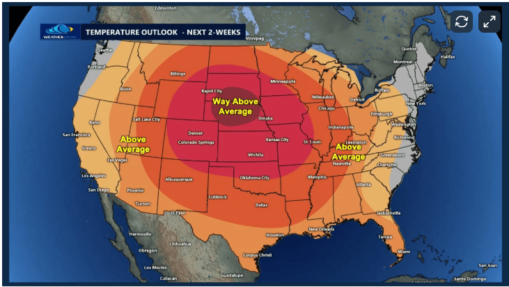
Now, what do the next 2 weeks look like? MUCH warmer weather for much of the Central US:
Here is the latest data from our patent pending LRC model outlook through SEPTEMBER. There will be a feast or famine rainfall pattern shown by the output from our Weather 20/20 Vision Dashboard.
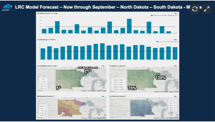
Overall for the Valley into Lakes country it looks like pretty normal in regards to rainfall AND temps.
If you would like to know MORE about the LRC, let me know. dean@weather2020.com